|
search place name
|
||
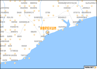
Abrekum (Ghana)Abrekum is a town in Ghana. An overview map of the region around Abrekum is displayed below.
regional and 3d topo map of Abrekum, Ghana ::
Abrekum airports ::
The nearest airport is ACC - Accra Kotoka Intl, located 69.7 km north east of Abrekum.
Other airports nearby include TKD - Takoradi (125.5 km west), LFW - Lome Gnassingbe Eyadema Intl (238.4 km north east), Nearby towns ::
Nsawam (1.8km west) //
Apam (2.6km south west) //
Adanka (2.6km north west) //
Brusheng (2.6km north west) //
Mankwadzi (4.1km north east) //
Mumford (5.2km south west) //
Abura (5.5km west) //
Mprumem (5.9km north) //
Munianu (5.8km east) //
Simbrofo (6.7km north west) //
Ankamu (6.7km north west) //
Otaw (7.4km north) //
Jukwa (7.4km north) //
Onyadzi (7.6km north) //
Ajumako (7.8km north west) //
Bidwadzi (7.8km north east) //
Amoanda (9.2km south west) //
Nkoranza (10.5km north west) //
[all distances 'as the bird flies' and approximate] 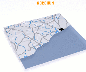 Places with similar names to Abrekum, Ghana ::
// Abrekuma (GH)
Disclaimer :: Information on this page comes without warranty of any kind |
||
|
Where is Abrekum? Elevation and coordinates ::
Latitude (lat): 5°18'0"N Longitude (lon): 0°43'0"W
Elevation (approx.): -32768m (map arrows pan, magnifying glasses zoom) |
||
|
Visiting Abrekum? Hotel/Accommodation ::
Book a hotel in Abrekum Travel Guide ::
Buy a travel guide for Ghana rental cars ::
car rental offers GPS waypoint ::
download a GPX waypoint (PoI) of Abrekum for your GPS receiver
|
||