|
search place name
|
||
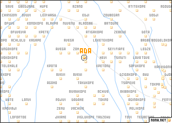
Ada (Ghana)Ada is a town in Ghana. An overview map of the region around Ada is displayed below.
regional and 3d topo map of Ada, Ghana ::
Ada airports ::
The nearest airport is LFW - Lome Gnassingbe Eyadema Intl, located 45.4 km east of Ada.
Other airports nearby include ACC - Accra Kotoka Intl (137.8 km south west), COO - Cotonou Cadjehoun (168.0 km east), Nearby towns ::
Kurasi (0.0km north) //
Seva (0.0km north) //
Hode (1.9km south) //
Afiadenyigba (1.9km north) //
Zomai (2.6km north west) //
Hevi (3.7km east) //
Avewi (4.1km south west) //
Kpetonu (4.1km south east) //
Kpedome (4.1km north east) //
Hokpo (4.1km north west) //
Lékétékopé (5.2km north east) //
Avega (5.2km north west) //
Have (5.6km north) //
Agblonu (5.6km south) //
Takukofe (5.6km south) //
Atiglime (5.5km east) //
Atiga Kopé (5.9km north) //
Seyi (5.8km east) //
Avega (5.8km west) //
Kove (5.8km west) //
Avevi (6.7km south west) //
Tsinuti (7.4km east) //
Alaogbé (7.4km north) //
Djayime (7.4km north) //
Djadjefe (7.4km north) //
Fiafe (7.6km east) //
Vojalogwi (7.6km south) //
Zolo (7.6km north) //
Ahlanfedo (7.6km south) //
[all distances 'as the bird flies' and approximate] 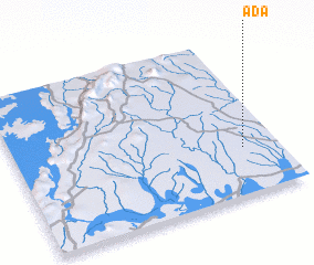 Places with similar names to Ada, Ghana ::
Disclaimer :: Information on this page comes without warranty of any kind |
||
|
Where is Ada? Elevation and coordinates ::
Latitude (lat): 6°18'0"N Longitude (lon): 0°52'0"W
Elevation (approx.): 78m (map arrows pan, magnifying glasses zoom) |
||
|
Visiting Ada? Hotel/Accommodation ::
Book a hotel in Ada Travel Guide ::
Buy a travel guide for Ghana rental cars ::
car rental offers GPS waypoint ::
download a GPX waypoint (PoI) of Ada for your GPS receiver
|
||