|
search place name
|
||
Ajwinasi (Ghana)Ajwinasi is a town in Ghana. An overview map of the region around Ajwinasi is displayed below.
regional and 3d topo map of Ajwinasi, Ghana ::

Ajwinasi airports ::
The nearest airport is NYI - Sunyani, located 131.0 km north west of Ajwinasi.
Other airports nearby include ACC - Accra Kotoka Intl (177.4 km south east), TKD - Takoradi (188.2 km south), Nearby towns ::
Piasi (1.9km north) //
Nyamieni (1.8km east) //
Deduako (1.9km south) //
Kawkawdei (3.7km west) //
Kofiayekrom (4.1km north east) //
Menibriba (4.1km north west) //
Abonu (4.1km south east) //
Ajuafo (4.1km south east) //
Kuntanasi (5.2km south west) //
Obo (5.2km south east) //
Domasi (5.6km north) //
Okroasi (5.9km north) //
Yasi (5.9km south) //
Pramiso (5.8km west) //
Abremkese (5.8km west) //
Kwamifosukrom (5.8km east) //
Krom Ajuafo (6.7km south west) //
Onwi (6.7km south west) //
Nkawi (6.7km south east) //
Asisiriwa (6.7km south east) //
Kwaso (7.4km north) //
Boniso (7.4km east) //
Anyatiasi (7.4km south) //
Jachi (7.4km west) //
Deduako (7.6km north) //
Ohenediem (7.6km north) //
Hamapanasi (7.8km north west) //
Timiabu (8.3km north east) //
Yaokwakwakrom (8.2km north east) //
[all distances 'as the bird flies' and approximate] 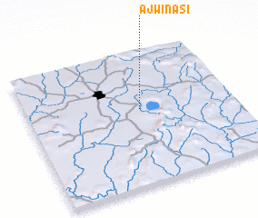 Places with similar names to Ajwinasi, Ghana ::
Disclaimer :: Information on this page comes without warranty of any kind |
||
|
Where is Ajwinasi? Elevation and coordinates ::
Latitude (lat): 6°34'0"N Longitude (lon): 1°27'0"W
Elevation (approx.): 248m (map arrows pan, magnifying glasses zoom) |
||
|
Visiting Ajwinasi? Hotel/Accommodation ::
Book a hotel in Ajwinasi Travel Guide ::
Buy a travel guide for Ghana rental cars ::
car rental offers GPS waypoint ::
download a GPX waypoint (PoI) of Ajwinasi for your GPS receiver
|
||