|
search place name
|
||
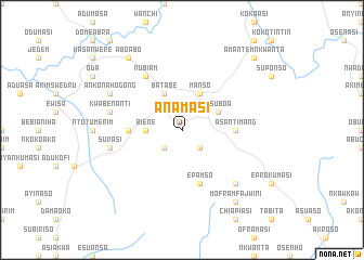
Anamasi (Ghana)Anamasi is a town in Ghana. An overview map of the region around Anamasi is displayed below.
regional and 3d topo map of Anamasi, Ghana ::
Anamasi airports ::
The nearest airport is ACC - Accra Kotoka Intl, located 86.2 km east of Anamasi.
Other airports nearby include TKD - Takoradi (144.6 km south west), NYI - Sunyani (228.7 km north west), Nearby towns ::
Kokobin (2.6km south west) //
Brofoyedru (2.6km south east) //
Biene (3.7km west) //
Adikuma (3.7km west) //
Asuboa (4.1km north east) //
Batabe (4.1km north west) //
Manso (4.1km north east) //
Anyinam (5.5km west) //
Asantimang (5.5km east) //
Epamso (5.9km south) //
Asene (6.7km north west) //
Nubiam (6.7km north west) //
Kwabenanti (7.6km west) //
Surasi (7.6km west) //
Akuamasi (7.8km south east) //
Ankonahogong (8.3km north west) //
Aboabo (9.2km north west) //
Moframfajwini (9.2km south east) //
Amantem Nkwanta (10.5km north east) //
[all distances 'as the bird flies' and approximate] 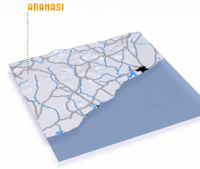 Places with similar names to Anamasi, Ghana ::
Disclaimer :: Information on this page comes without warranty of any kind |
||
|
Where is Anamasi? Elevation and coordinates ::
Latitude (lat): 5°52'0"N Longitude (lon): 0°54'0"W
Elevation (approx.): 170m (map arrows pan, magnifying glasses zoom) |
||
|
Visiting Anamasi? Hotel/Accommodation ::
Book a hotel in Anamasi Travel Guide ::
Buy a travel guide for Ghana rental cars ::
car rental offers GPS waypoint ::
download a GPX waypoint (PoI) of Anamasi for your GPS receiver
|
||