|
search place name
|
||
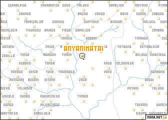
Anyanimatai (Ghana)Anyanimatai is a town in Ghana. An overview map of the region around Anyanimatai is displayed below.
regional and 3d topo map of Anyanimatai, Ghana ::
Anyanimatai airports ::
The nearest airport is TML - Tamale, located 159.9 km south of Anyanimatai.
Other airports nearby include OUA - Ouagadougou (202.1 km north west), LRL - Niatougou Niamtougou International (204.1 km south east), Nearby towns ::
Gumshe (2.6km south east) //
Timoni (3.6km west) //
Nafkuliga (3.7km south) //
Biringo (4.1km north west) //
Sapari (4.1km north east) //
Tanseiga (4.1km north east) //
Yorugu (5.2km north west) //
Nohu Bode (5.2km south west) //
Yadebode (5.2km south west) //
Sapeliga (5.6km north) //
Zaga (5.6km south) //
Kado (5.8km east) //
Kulago (5.9km south) //
Tiego (6.6km north west) //
Kupaligogo (6.6km north east) //
Voko (6.6km south east) //
Bondari (7.3km west) //
Ziego (7.5km west) //
Gunyioko (7.6km north) //
Tanga (7.5km west) //
Saka (7.8km north west) //
Kpalisako (7.8km south west) //
Tune (8.2km south west) //
Aniago (9.2km north west) //
Goruku (9.2km north west) //
Sitane (9.2km south west) //
Binduri (10.4km north east) //
[all distances 'as the bird flies' and approximate] 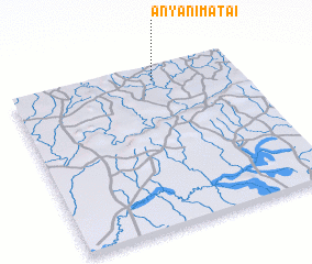 Places with similar names to Anyanimatai, Ghana :: Disclaimer :: Information on this page comes without warranty of any kind |
||
|
Where is Anyanimatai? Elevation and coordinates ::
Latitude (lat): 10°55'0"N Longitude (lon): 0°22'0"W
Elevation (approx.): 172m (map arrows pan, magnifying glasses zoom) |
||
|
Visiting Anyanimatai? Hotel/Accommodation ::
Book a hotel in Anyanimatai Travel Guide ::
Buy a travel guide for Ghana rental cars ::
car rental offers GPS waypoint ::
download a GPX waypoint (PoI) of Anyanimatai for your GPS receiver
|
||