|
search place name
|
||
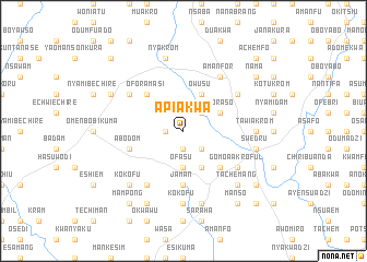
Apiakwa (Ghana)Apiakwa is a town in Ghana. An overview map of the region around Apiakwa is displayed below.
regional and 3d topo map of Apiakwa, Ghana ::
Apiakwa airports ::
The nearest airport is ACC - Accra Kotoka Intl, located 66.7 km east of Apiakwa.
Other airports nearby include TKD - Takoradi (133.1 km south west), NYI - Sunyani (264.6 km north west), Nearby towns ::
Kwadum (1.8km west) //
Afuwa (1.9km south) //
Boifi (1.9km south) //
Akwachi (2.6km south east) //
Nkranfo (2.6km north east) //
Ofasu (3.7km south) //
Akwamu (4.1km south east) //
Owusu (4.1km north east) //
Afransi (4.1km south east) //
Akoraso (4.1km north east) //
Oforamasi (5.2km north west) //
Bisade (5.2km south east) //
Achiasi (5.2km south east) //
Jaman (5.6km south) //
Abodom (5.8km west) //
Aditekorasi (6.7km north west) //
Fomena (6.7km south west) //
Bionso (6.7km south east) //
Jakobkrom (6.7km north east) //
Gomoa Akroful (6.7km south east) //
Aboso (6.7km south east) //
Amanfor (6.7km north east) //
Kokofu (7.4km south) //
Tawiakrom (7.4km east) //
Nyakrom (7.6km north) //
Dahum (7.6km south) //
Bebianiha (7.6km east) //
Jwewuhu (7.6km east) //
Swedru (7.6km east) //
[all distances 'as the bird flies' and approximate] 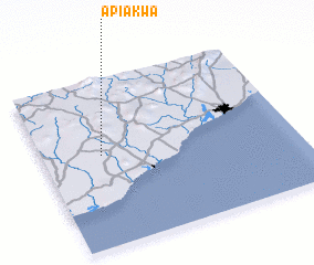 Places with similar names to Apiakwa, Ghana ::
// Apaukwa (MM)
Disclaimer :: Information on this page comes without warranty of any kind |
||
|
Where is Apiakwa? Elevation and coordinates ::
Latitude (lat): 5°33'0"N Longitude (lon): 0°46'0"W
Elevation (approx.): 119m (map arrows pan, magnifying glasses zoom) |
||
|
Visiting Apiakwa? Hotel/Accommodation ::
Book a hotel in Apiakwa Travel Guide ::
Buy a travel guide for Ghana rental cars ::
car rental offers GPS waypoint ::
download a GPX waypoint (PoI) of Apiakwa for your GPS receiver
|
||