|
search place name
|
||
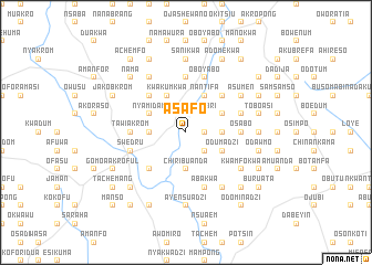
Asafo (Ghana)Asafo is a town in Ghana. An overview map of the region around Asafo is displayed below.
regional and 3d topo map of Asafo, Ghana ::
Asafo airports ::
The nearest airport is ACC - Accra Kotoka Intl, located 53.9 km east of Asafo.
Other airports nearby include TKD - Takoradi (144.1 km south west), LFW - Lome Gnassingbe Eyadema Intl (221.6 km east), NYI - Sunyani (273.2 km north west), Nearby towns ::
Kwachekrom (1.8km east) //
Amumukwa (2.6km south east) //
Ofebri (2.6km north east) //
Chiribuanda (3.7km south) //
Kwansakrom (3.7km west) //
Ochokrom (3.7km east) //
Kwakumkwa (4.1km north west) //
Nantifa (4.1km north east) //
Nyansachere (4.1km north east) //
Bisade (4.1km north west) //
Nyamidam (4.1km north west) //
Odumadzi (4.1km south east) //
Kwesichukwa (4.1km north east) //
Ateplo (5.2km south west) //
Famaye (5.2km north east) //
Buawoma (5.2km north west) //
Kotukrom (5.2km north west) //
Kukoadu (5.6km north) //
Tawiakrom (5.5km west) //
Osabo (5.5km east) //
Kwanyaku (5.9km north) //
Ndebehi (5.9km south) //
Abakwa (5.9km south) //
Oboyabo (5.9km north) //
Jwewuhu (5.8km west) //
Bebianiha (5.8km west) //
Swedru (5.8km west) //
Biuasi (5.8km east) //
Echifikwa (6.7km south east) //
[all distances 'as the bird flies' and approximate]  Places with similar names to Asafo, Ghana ::
Disclaimer :: Information on this page comes without warranty of any kind |
||
|
Where is Asafo? Elevation and coordinates ::
Latitude (lat): 5°33'0"N Longitude (lon): 0°39'0"W
Elevation (approx.): 38m (map arrows pan, magnifying glasses zoom) |
||
|
Visiting Asafo? Hotel/Accommodation ::
Book a hotel in Asafo Travel Guide ::
Buy a travel guide for Ghana rental cars ::
car rental offers GPS waypoint ::
download a GPX waypoint (PoI) of Asafo for your GPS receiver
|
||