|
search place name
|
||
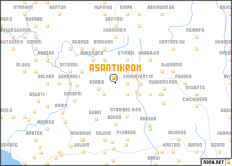
Asantikrom (Ghana)Asantikrom is a town in Ghana. An overview map of the region around Asantikrom is displayed below.
regional and 3d topo map of Asantikrom, Ghana ::
Asantikrom airports ::
The nearest airport is TKD - Takoradi, located 39.6 km east of Asantikrom.
Other airports nearby include ABJ - Abidjan Felix Houphouet Boigny Intl (202.7 km west), ACC - Accra Kotoka Intl (226.3 km east), Nearby towns ::
Nyaben (1.8km east) //
Pomponadie (2.6km south east) //
Ebunaso (2.6km north east) //
Mensakrom (2.7km south west) //
Asabie (3.0km west) //
Nyanso (3.5km south east) //
Chirinyenyim (3.7km east) //
Esamang (3.9km east) //
Bahobi (4.1km north west) //
Etinasi (4.1km north east) //
Akoro (4.1km north east) //
Nkrang (4.1km south east) //
Sukusuku (5.2km north west) //
Nyamibechire (5.7km south) //
Asakwam (5.9km north) //
Bamiankaw (5.8km west) //
Adubrim (5.8km east) //
Aniben (6.3km west) //
Subri (6.6km south west) //
Bokro (6.7km south) //
Antobam (6.7km north west) //
Kwadajin (6.7km north east) //
Kokofri (7.3km south west) //
Achim Dada (7.3km east) //
Domenasi (7.4km west) //
Kwamkrom (7.4km north) //
Aiyinasi (7.6km west) //
Atokobaka (7.6km east) //
Ajabinkrom (7.6km east) //
[all distances 'as the bird flies' and approximate] 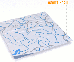 Places with similar names to Asantikrom, Ghana ::
Disclaimer :: Information on this page comes without warranty of any kind |
||
|
Where is Asantikrom? Elevation and coordinates ::
Latitude (lat): 5°0'0"N Longitude (lon): 2°7'0"W
Elevation (approx.): 96m (map arrows pan, magnifying glasses zoom) |
||
|
Visiting Asantikrom? Hotel/Accommodation ::
Book a hotel in Asantikrom Travel Guide ::
Buy a travel guide for Ghana rental cars ::
car rental offers GPS waypoint ::
download a GPX waypoint (PoI) of Asantikrom for your GPS receiver
|
||