|
search place name
|
||
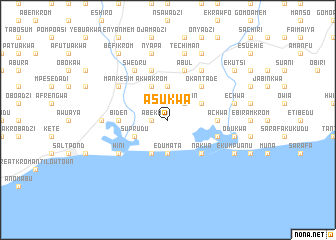
Asukwa (Ghana)Asukwa is a town in Ghana. An overview map of the region around Asukwa is displayed below.
regional and 3d topo map of Asukwa, Ghana ::
Asukwa airports ::
The nearest airport is TKD - Takoradi, located 97.1 km south west of Asukwa.
Other airports nearby include ACC - Accra Kotoka Intl (97.7 km north east), Nearby towns ::
Abeka (1.8km west) //
Nanabin (2.6km north east) //
Edumata (3.7km south) //
Adukuma (3.7km north) //
Asaafa (4.1km south west) //
Suprudu (4.1km south west) //
Akwakrom (4.1km north west) //
Bojwanu (4.1km north east) //
Nakwa (5.2km south east) //
Okantade (5.2km north east) //
Achwa (5.5km east) //
Abuakwa (5.5km east) //
Biden (5.5km west) //
Okwakwa (5.9km north) //
Anumenchen (5.9km north) //
Einado (5.8km east) //
Abul (5.9km north) //
Swedru (6.7km north west) //
Hini (6.7km south west) //
Eisam (6.7km north east) //
Mankesim (6.7km north west) //
Abonku (7.4km west) //
Nyapa (7.6km north) //
Kwaprakwa (7.6km east) //
Odukwa (7.6km east) //
Eduakwa (7.6km north) //
Techiman (7.6km north) //
Echwa (7.6km east) //
Atsuakrom (7.6km east) //
[all distances 'as the bird flies' and approximate] 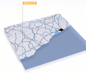 Places with similar names to Asukwa, Ghana ::
Disclaimer :: Information on this page comes without warranty of any kind |
||
|
Where is Asukwa? Elevation and coordinates ::
Latitude (lat): 5°14'0"N Longitude (lon): 0°58'0"W
Elevation (approx.): 16m (map arrows pan, magnifying glasses zoom) |
||
|
Visiting Asukwa? Hotel/Accommodation ::
Book a hotel in Asukwa Travel Guide ::
Buy a travel guide for Ghana rental cars ::
car rental offers GPS waypoint ::
download a GPX waypoint (PoI) of Asukwa for your GPS receiver
|
||