|
search place name
|
||
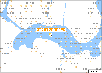
Atawtrobenya (Ghana)Atawtrobenya is a town in Ghana. An overview map of the region around Atawtrobenya is displayed below.
regional and 3d topo map of Atawtrobenya, Ghana ::
Atawtrobenya airports ::
The nearest airport is ACC - Accra Kotoka Intl, located 69.0 km south west of Atawtrobenya.
Other airports nearby include LFW - Lome Gnassingbe Eyadema Intl (113.4 km east), Nearby towns ::
Lupunya (0.0km north) //
Yopwe (2.6km south west) //
Takpe (2.6km north west) //
Pehuasi (2.6km north west) //
Keyumi (2.6km north west) //
Adapwi (2.6km north east) //
Avapo (2.6km north east) //
Volivo (2.6km north east) //
Asuchuali (3.7km west) //
Lomen (3.7km west) //
Vesekpo (3.7km north) //
Klebwenya (4.1km south east) //
Alabonyu (4.1km north west) //
Alablaboi (4.1km north west) //
Kabuteti (4.1km north east) //
New Dufo (4.1km north east) //
Kojokope (5.2km south east) //
Kasunya (5.2km south east) //
Avakpe (5.2km north west) //
Dufo (5.5km east) //
Bokpo (5.5km east) //
Hedohekumi (5.5km east) //
Soga (5.6km north) //
Kotoko (5.8km east) //
Numuchu (5.8km east) //
Ashimi (5.8km east) //
Blonya (5.8km west) //
Kwasivi (5.8km east) //
Yukunya (6.7km south west) //
[all distances 'as the bird flies' and approximate] 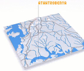 Places with similar names to Atawtrobenya, Ghana :: Disclaimer :: Information on this page comes without warranty of any kind |
||
|
Where is Atawtrobenya? Elevation and coordinates ::
Latitude (lat): 6°5'0"N Longitude (lon): 0°14'0"W
Elevation (approx.): 9m (map arrows pan, magnifying glasses zoom) |
||
|
Visiting Atawtrobenya? Hotel/Accommodation ::
Book a hotel in Atawtrobenya Travel Guide ::
Buy a travel guide for Ghana rental cars ::
car rental offers GPS waypoint ::
download a GPX waypoint (PoI) of Atawtrobenya for your GPS receiver
|
||