|
search place name
|
||
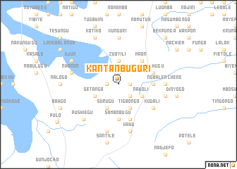
Kantanbuguri (Ghana)Kantanbuguri is a town in Ghana. An overview map of the region around Kantanbuguri is displayed below.
regional and 3d topo map of Kantanbuguri, Ghana ::
Kantanbuguri airports ::
The nearest airport is TML - Tamale, located 96.9 km south west of Kantanbuguri.
Other airports nearby include LRL - Niatougou Niamtougou International (137.9 km east), Nearby towns ::
Yabogo (1.8km east) //
Sakpale (1.8km west) //
Genguna (1.9km north) //
Konkonjani (2.6km south east) //
Zuoyili (3.7km north) //
Tigbongo (4.1km south east) //
Nakoli (4.1km south east) //
Surugu (4.1km south west) //
Setanga (4.1km south west) //
Maon (5.2km north east) //
Gbane (5.5km east) //
Sambobugu (5.6km south) //
Masidjun (5.9km south) //
Nawchugu (5.8km east) //
Kudali (6.6km south east) //
Ngbalenchere (7.3km east) //
Kunguri (7.4km north) //
Klukpanga (7.5km east) //
Wawu (7.6km south) //
Nworon (7.5km west) //
Solochojachale (7.6km south) //
Pushiegu (7.8km south west) //
Djun (8.2km north west) //
Kotiko (8.3km north west) //
Dekpunga (10.4km north east) //
[all distances 'as the bird flies' and approximate] 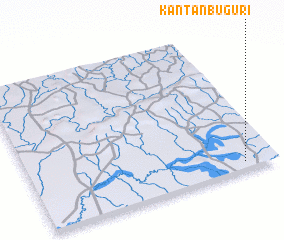 Places with similar names to Kantanbuguri, Ghana :: Disclaimer :: Information on this page comes without warranty of any kind |
||
|
Where is Kantanbuguri? Elevation and coordinates ::
Latitude (lat): 10°3'0"N Longitude (lon): 0°8'0"W
Elevation (approx.): 198m (map arrows pan, magnifying glasses zoom) |
||
|
Visiting Kantanbuguri? Hotel/Accommodation ::
Book a hotel in Kantanbuguri Travel Guide ::
Buy a travel guide for Ghana rental cars ::
car rental offers GPS waypoint ::
download a GPX waypoint (PoI) of Kantanbuguri for your GPS receiver
|
||