|
search place name
|
||
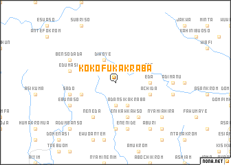
Kokofu Kakraba (Ghana)Kokofu Kakraba is a town in Ghana. An overview map of the region around Kokofu Kakraba is displayed below.
regional and 3d topo map of Kokofu Kakraba, Ghana ::
Kokofu Kakraba airports ::
The nearest airport is TKD - Takoradi, located 25.2 km south of Kokofu Kakraba.
Other airports nearby include ACC - Accra Kotoka Intl (192.5 km east), Nearby towns ::
Ketekrom (2.6km north west) //
Amantin Dada (2.6km north west) //
Manso (3.7km south) //
Diwoye (4.1km north west) //
Adansi Kakraba (4.1km south east) //
Eda (5.5km east) //
Enikawkawso (5.9km south) //
Ada (5.8km east) //
Achida (5.8km east) //
Nyamibechere (5.8km west) //
Bremang (6.7km south east) //
Alaham (6.7km south east) //
Neneda (6.7km south west) //
Ajei (7.4km south) //
Enenide (7.6km south) //
Edumasi (7.6km west) //
Sado (7.6km west) //
Benso Dada (8.3km north west) //
Benso (8.3km north west) //
Ebunaso (8.3km south west) //
Nyamiahira (9.2km south east) //
Aburi (9.3km south east) //
Angu (10.5km south east) //
Adum Banso (10.5km south west) //
[all distances 'as the bird flies' and approximate] 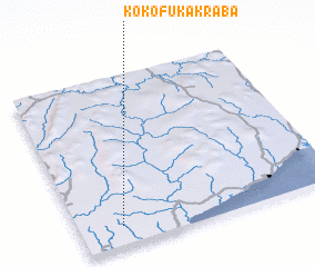 Places with similar names to Kokofu Kakraba, Ghana :: Disclaimer :: Information on this page comes without warranty of any kind |
||
|
Where is Kokofu Kakraba? Elevation and coordinates ::
Latitude (lat): 5°7'0"N Longitude (lon): 1°50'0"W
Elevation (approx.): 88m (map arrows pan, magnifying glasses zoom) |
||
|
Visiting Kokofu Kakraba? Hotel/Accommodation ::
Book a hotel in Kokofu Kakraba Travel Guide ::
Buy a travel guide for Ghana rental cars ::
car rental offers GPS waypoint ::
download a GPX waypoint (PoI) of Kokofu Kakraba for your GPS receiver
|
||