|
search place name
|
||
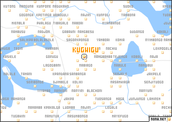
Kugwigu (Ghana)Kugwigu is a town in Ghana. An overview map of the region around Kugwigu is displayed below.
regional and 3d topo map of Kugwigu, Ghana ::
Kugwigu airports ::
The nearest airport is TML - Tamale, located 119.0 km south west of Kugwigu.
Other airports nearby include LRL - Niatougou Niamtougou International (134.4 km south east), Nearby towns ::
Miantele (0.0km north) //
Tindongo (0.0km north) //
Oberade (1.8km west) //
Nabiago (1.9km south) //
Bundure (2.6km south east) //
Nangan (2.6km north east) //
Nasuo (2.6km north west) //
Nabeyin (2.6km south west) //
Moago (3.6km east) //
Namgbamba (3.6km east) //
Kukpoku (3.7km north) //
Dogutetiego (4.1km north east) //
Sagorkpongo (4.1km north west) //
Sanbanga (4.1km south west) //
Yamboai (5.2km north east) //
Nababiri (5.5km east) //
Namgbesu (5.6km north) //
Nachiu (5.8km east) //
Koliki (5.9km south) //
Nakurugu (5.9km north) //
Kpandana (6.6km south west) //
Bankali (6.6km south east) //
Gabawni (6.6km north west) //
Betei (6.6km south west) //
Tejenga (7.3km east) //
Gorugu (7.3km west) //
Nangwala (7.4km south) //
Nabule (7.5km east) //
Blachoni (7.6km south) //
[all distances 'as the bird flies' and approximate] 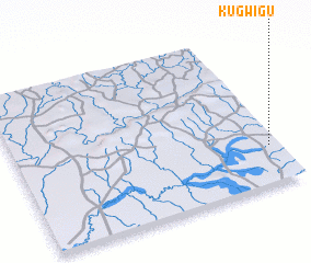
Disclaimer :: Information on this page comes without warranty of any kind |
||
|
Where is Kugwigu? Elevation and coordinates ::
Latitude (lat): 10°15'0"N Longitude (lon): 0°2'0"W
Elevation (approx.): 176m (map arrows pan, magnifying glasses zoom) |
||
|
Visiting Kugwigu? Hotel/Accommodation ::
Book a hotel in Kugwigu Travel Guide ::
Buy a travel guide for Ghana rental cars ::
car rental offers GPS waypoint ::
download a GPX waypoint (PoI) of Kugwigu for your GPS receiver
|
||