|
search place name
|
||
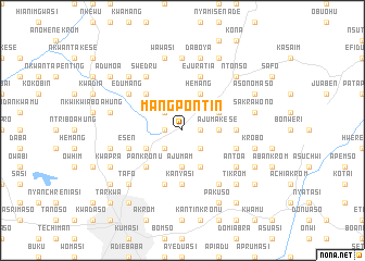
Mangpontin (Ghana)Mangpontin is a town in Ghana. An overview map of the region around Mangpontin is displayed below.
regional and 3d topo map of Mangpontin, Ghana ::
Mangpontin airports ::
The nearest airport is NYI - Sunyani, located 105.7 km north west of Mangpontin.
Other airports nearby include ACC - Accra Kotoka Intl (202.4 km south east), TKD - Takoradi (210.0 km south), Nearby towns ::
Bamparasi (1.8km west) //
Dumanafo (1.8km east) //
Asinua (2.6km south west) //
Fawubawari (2.6km south west) //
Samang (2.6km south east) //
Asuminya (2.6km north west) //
Ajumam (3.7km south) //
Ajumakese (3.7km east) //
Ehwia (4.1km south west) //
Abirem (4.1km south east) //
Hemang (4.1km north east) //
Aboabo Nkwanta (4.1km north east) //
Pankronu (5.2km south west) //
Ajumakese (5.2km north west) //
Kanyasi (5.6km south) //
Duasi (5.6km south) //
Ahunjo (5.5km east) //
Esen (5.8km west) //
Buokrom (5.9km south) //
Adeusina (5.8km east) //
Ejuratia (5.9km north) //
Swedru (6.7km north west) //
Antoa (6.7km south east) //
Achiasi (6.7km south east) //
Edumang (6.6km north west) //
Jamasi (6.7km south east) //
Mpobi (7.4km north) //
Brunkum (7.6km west) //
Mowire (7.6km west) //
[all distances 'as the bird flies' and approximate]  Places with similar names to Mangpontin, Ghana :: Disclaimer :: Information on this page comes without warranty of any kind |
||
|
Where is Mangpontin? Elevation and coordinates ::
Latitude (lat): 6°47'0"N Longitude (lon): 1°34'0"W
Elevation (approx.): 297m (map arrows pan, magnifying glasses zoom) |
||
|
Visiting Mangpontin? Hotel/Accommodation ::
Book a hotel in Mangpontin Travel Guide ::
Buy a travel guide for Ghana rental cars ::
car rental offers GPS waypoint ::
download a GPX waypoint (PoI) of Mangpontin for your GPS receiver
|
||