|
search place name
|
||
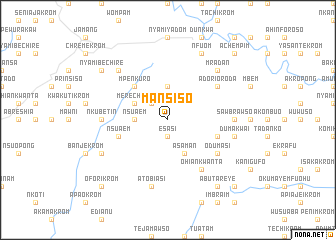
Mansiso (Ghana)Mansiso is a town in Ghana. An overview map of the region around Mansiso is displayed below.
regional and 3d topo map of Mansiso, Ghana ::
Mansiso airports ::
The nearest airport is TKD - Takoradi, located 109.3 km south of Mansiso.
Other airports nearby include NYI - Sunyani (173.0 km north), ACC - Accra Kotoka Intl (185.3 km east), Nearby towns ::
Esasi (1.9km south) //
Asikuma (2.6km north west) //
Nsuaem (3.7km west) //
Chirebraso (3.7km north) //
Merechuso (4.1km north west) //
Asaman (4.1km south east) //
Mpenkuro (5.2km north west) //
Nsuaem (5.8km west) //
Buabin (5.8km east) //
Ninety (6.7km south east) //
Odumasi (6.7km south east) //
Adorior Oda (6.7km north east) //
Ohiankwanta (6.7km south east) //
Nkubetin (7.4km west) //
Sawbrawso (7.4km east) //
Atobiasi (7.6km south) //
Dumakwai (7.6km east) //
Achiasi (7.8km north west) //
Abuakwankwanta (7.8km north east) //
Mradan (7.8km north east) //
Ayaboi (8.3km south west) //
Kodajwen (8.3km north east) //
Nfuom (8.3km north east) //
Nyamibechire (9.2km north west) //
Abutareye (9.2km south east) //
Oforikrom (10.5km south west) //
Akotem (10.5km south east) //
Achempim (10.5km north east) //
[all distances 'as the bird flies' and approximate] 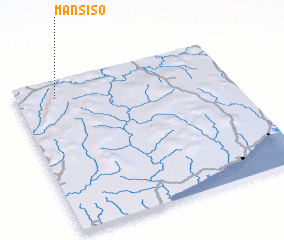 Places with similar names to Mansiso, Ghana ::
Disclaimer :: Information on this page comes without warranty of any kind |
||
|
Where is Mansiso? Elevation and coordinates ::
Latitude (lat): 5°53'0"N Longitude (lon): 1°49'0"W
Elevation (approx.): 168m (map arrows pan, magnifying glasses zoom) |
||
|
Visiting Mansiso? Hotel/Accommodation ::
Book a hotel in Mansiso Travel Guide ::
Buy a travel guide for Ghana rental cars ::
car rental offers GPS waypoint ::
download a GPX waypoint (PoI) of Mansiso for your GPS receiver
|
||