|
search place name
|
||
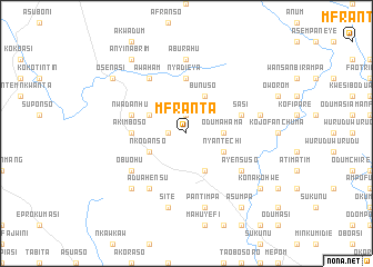
Mfranta (Ghana)Mfranta is a town in Ghana. An overview map of the region around Mfranta is displayed below.
regional and 3d topo map of Mfranta, Ghana ::
Mfranta airports ::
The nearest airport is ACC - Accra Kotoka Intl, located 65.9 km south east of Mfranta.
Other airports nearby include TKD - Takoradi (164.2 km south west), LFW - Lome Gnassingbe Eyadema Intl (216.5 km east), NYI - Sunyani (243.4 km north west), Nearby towns ::
Jaman (1.8km west) //
Juafoakwa (1.8km west) //
Abuchenso (1.9km north) //
Odumahama (3.7km east) //
Amantran (3.7km east) //
Bunuso (4.1km north east) //
Asamankese (4.1km south east) //
Nyantechi (4.1km south east) //
Nkodanso (4.1km south west) //
Kwabinato (4.1km south west) //
Ahamahama (4.1km north west) //
Nyadieya (5.6km north) //
Akimboso (5.5km west) //
Ekawso (5.5km west) //
Nwadanhu (5.8km west) //
Sasi (5.8km east) //
Obuohu (6.7km south west) //
Ayensuso (6.7km south east) //
Awaham (6.7km north west) //
Aduahensu (6.7km south west) //
Aburahu (7.4km north) //
Odumasi (7.6km east) //
Pantimpa (7.6km south) //
Kodiabe (7.6km south) //
Abisim (7.6km south) //
Site (7.6km south) //
Abuchen (7.8km south west) //
Ansum (9.2km south east) //
Konakohwe (9.2km south east) //
[all distances 'as the bird flies' and approximate]  Places with similar names to Mfranta, Ghana ::
// Mfranta (GH)
Disclaimer :: Information on this page comes without warranty of any kind |
||
|
Where is Mfranta? Elevation and coordinates ::
Latitude (lat): 5°54'0"N Longitude (lon): 0°41'0"W
Elevation (approx.): 188m (map arrows pan, magnifying glasses zoom) |
||
|
Visiting Mfranta? Hotel/Accommodation ::
Book a hotel in Mfranta Travel Guide ::
Buy a travel guide for Ghana rental cars ::
car rental offers GPS waypoint ::
download a GPX waypoint (PoI) of Mfranta for your GPS receiver
|
||