|
search place name
|
||
Nchenechene (Ghana)Nchenechene is a town in Ghana. An overview map of the region around Nchenechene is displayed below.
regional and 3d topo map of Nchenechene, Ghana ::

Nchenechene airports ::
The nearest airport is ACC - Accra Kotoka Intl, located 28.7 km south east of Nchenechene.
Other airports nearby include LFW - Lome Gnassingbe Eyadema Intl (178.2 km east), TKD - Takoradi (191.0 km south west), Nearby towns ::
Ngwakwesi (1.9km north) //
Nchenechene (1.9km north) //
Ahunju (1.9km south) //
Aheriso (2.6km north east) //
Adwajiri (3.7km west) //
Oyinso (3.7km south) //
Ajeiagbo (4.1km north west) //
Kumau (4.1km north west) //
Nsawam (4.1km south west) //
Djankrom (4.1km south west) //
Ankwadoboro (4.1km south west) //
Doboro (4.1km south east) //
Sansame (4.1km south east) //
Doboro (4.1km south east) //
Akufo (5.2km north west) //
Sansame (5.2km north west) //
Otopokwamikrom (5.2km north east) //
Nsumia (5.2km south west) //
Mpehuasem (5.2km south east) //
Ebron (5.6km south) //
Asikabiu (5.6km north) //
Midie (5.9km south) //
Ashwenanmo (5.9km south) //
Asikabiu (5.9km north) //
Buokrom (5.9km north) //
Aheriso (5.8km east) //
Koleman (5.9km south) //
Ahamahama (5.9km north) //
Sachikrom (5.8km west) //
[all distances 'as the bird flies' and approximate] 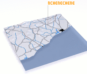 Places with similar names to Nchenechene, Ghana ::
Disclaimer :: Information on this page comes without warranty of any kind |
||
|
Where is Nchenechene? Elevation and coordinates ::
Latitude (lat): 5°49'0"N Longitude (lon): 0°19'0"W
Elevation (approx.): 98m (map arrows pan, magnifying glasses zoom) |
||
|
Visiting Nchenechene? Hotel/Accommodation ::
Book a hotel in Nchenechene Travel Guide ::
Buy a travel guide for Ghana rental cars ::
car rental offers GPS waypoint ::
download a GPX waypoint (PoI) of Nchenechene for your GPS receiver
|
||