|
search place name
|
||
Nsama (Western, Ghana)Nsama is a town in the Western region of Ghana. An overview map of the region around Nsama is displayed below.
regional and 3d topo map of Nsama, Ghana ::

Nsama airports ::
The nearest airport is TKD - Takoradi, located 39.9 km north east of Nsama.
Other airports nearby include ABJ - Abidjan Felix Houphouet Boigny Intl (209.2 km west), ACC - Accra Kotoka Intl (234.6 km north east), Nearby towns ::
Awusenu (1.2km north east) //
Aketechi (2.2km north) //
Atinchin (2.8km south east) //
Sefwi (3.2km north east) //
Akrakrom (4.6km east) //
Nkatakado (4.7km north) //
Princes Town (4.9km north west) //
Seo (5.7km north) //
Asuboi (5.7km north) //
Auchiri (6.5km north) //
Anchenin (6.6km north west) //
Tuesi (6.7km north east) //
Sinamou (7.0km north east) //
Nkwantanang (7.0km north east) //
Katakwo (7.1km east) //
Mutrakni (7.6km north west) //
Ataraso (7.9km north east) //
Anwian (8.1km north west) //
Fupiri (8.5km north west) //
Asiekrom (8.6km east) //
Miemia (8.7km north west) //
Achenim (8.7km east) //
Animakrom (9.2km north) //
Ajemra (10.6km north west) //
[all distances 'as the bird flies' and approximate] 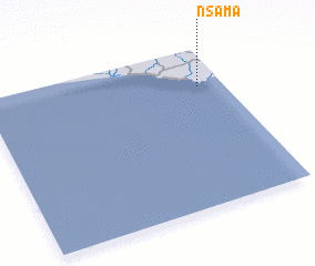 Places with similar names to Nsama, Ghana ::
Disclaimer :: Information on this page comes without warranty of any kind |
||
|
Where is Nsama? Elevation and coordinates ::
Latitude (lat): 4°45'31"N Longitude (lon): 2°6'27"W
Elevation (approx.): 49m (map arrows pan, magnifying glasses zoom) |
||
|
Visiting Nsama? Hotel/Accommodation ::
Book a hotel in Nsama Travel Guide ::
Buy a travel guide for Ghana rental cars ::
car rental offers GPS waypoint ::
download a GPX waypoint (PoI) of Nsama for your GPS receiver
|
||