|
search place name
|
||
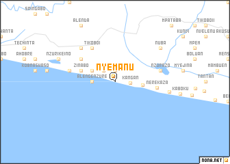
Nyemanu (Ghana)Nyemanu is a town in Ghana. An overview map of the region around Nyemanu is displayed below.
regional and 3d topo map of Nyemanu, Ghana ::
Nyemanu airports ::
The nearest airport is TKD - Takoradi, located 99.6 km east of Nyemanu.
Other airports nearby include ABJ - Abidjan Felix Houphouet Boigny Intl (142.6 km west), Nearby towns ::
Twenani (1.9km north) //
Kangan (2.5km east) //
Awalka (2.6km north west) //
Alawuri (2.6km north west) //
Alengenzure (3.7km west) //
Ajesa (4.1km north west) //
Aloen (4.5km east) //
Atrabasa (5.8km west) //
Zinabo (5.8km west) //
Tikobo I (6.7km north west) //
Ndumswaso (6.7km north west) //
Nerekaza (6.9km east) //
Bonyeri (7.6km west) //
Nzurazo (7.6km east) //
Nauli (7.8km north west) //
Beyin (9.0km east) //
Nuba (9.2km north east) //
[all distances 'as the bird flies' and approximate] 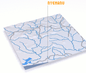 Places with similar names to Nyemanu, Ghana ::
Disclaimer :: Information on this page comes without warranty of any kind |
||
|
Where is Nyemanu? Elevation and coordinates ::
Latitude (lat): 5°0'0"N Longitude (lon): 2°40'0"W
Elevation (approx.): -32768m (map arrows pan, magnifying glasses zoom) |
||
|
Visiting Nyemanu? Hotel/Accommodation ::
Book a hotel in Nyemanu Travel Guide ::
Buy a travel guide for Ghana rental cars ::
car rental offers GPS waypoint ::
download a GPX waypoint (PoI) of Nyemanu for your GPS receiver
|
||