|
search place name
|
||
Obosono (Ghana)Obosono is a town in Ghana. An overview map of the region around Obosono is displayed below.
regional and 3d topo map of Obosono, Ghana ::

Obosono airports ::
The nearest airport is ACC - Accra Kotoka Intl, located 34.4 km south of Obosono.
Other airports nearby include LFW - Lome Gnassingbe Eyadema Intl (170.9 km east), TKD - Takoradi (200.7 km south west), Nearby towns ::
Odumtokro (1.8km west) //
Ankwaieso (1.8km east) //
Ajena (2.6km north west) //
Anamloampa (2.6km south east) //
Moframfadjini (2.6km south east) //
Teiko (3.7km north) //
Latebibio (3.7km west) //
Deigo (3.7km south) //
Budu (4.1km north west) //
Wansanbirampa (4.1km north west) //
Sonkonya (4.1km north east) //
Tarankoro (4.1km north west) //
Niensi (4.1km south east) //
Ahamahama (5.2km south west) //
Aboabo (5.2km north east) //
Apantem (5.2km south east) //
Kwakuafum (5.6km north) //
Pakro (5.5km west) //
Aheriso (5.6km south) //
Old Mangoasi (5.9km north) //
Otopokwamikrom (5.9km south) //
Chiripon (5.8km east) //
Pruso (5.8km east) //
Bepawso (5.8km east) //
Niensi (5.8km east) //
Abrimso (5.8km west) //
Mangoasi (6.7km north west) //
Metemano (6.7km north west) //
Adawso (6.7km north east) //
[all distances 'as the bird flies' and approximate] 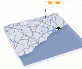 Places with similar names to Obosono, Ghana ::
Disclaimer :: Information on this page comes without warranty of any kind |
||
|
Where is Obosono? Elevation and coordinates ::
Latitude (lat): 5°54'0"N Longitude (lon): 0°16'0"W
Elevation (approx.): 135m (map arrows pan, magnifying glasses zoom) |
||
|
Visiting Obosono? Hotel/Accommodation ::
Book a hotel in Obosono Travel Guide ::
Buy a travel guide for Ghana rental cars ::
car rental offers GPS waypoint ::
download a GPX waypoint (PoI) of Obosono for your GPS receiver
|
||