|
search place name
|
||
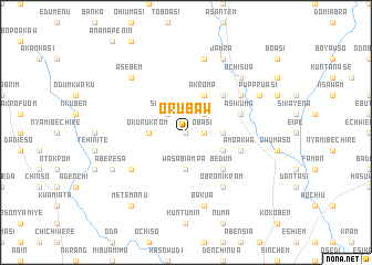
Orubaw (Ghana)Orubaw is a town in Ghana. An overview map of the region around Orubaw is displayed below.
regional and 3d topo map of Orubaw, Ghana ::
Orubaw airports ::
The nearest airport is ACC - Accra Kotoka Intl, located 97.9 km east of Orubaw.
Other airports nearby include TKD - Takoradi (109.3 km south west), NYI - Sunyani (243.8 km north west), Nearby towns ::
Kwanopado (0.0km north) //
Paprawchi (0.0km north) //
Obasi (1.8km east) //
Hasuwodi (2.6km north east) //
Suponso (2.6km north west) //
Baku (2.6km north east) //
Krobuasi (2.6km north east) //
Ntetia (3.7km east) //
Okurukrom (3.7km west) //
Esukawkaw (3.7km east) //
Wasabiampa (3.7km south) //
Akroma (4.1km north east) //
Akrofufu (4.1km south east) //
Mresachi (5.2km north east) //
Asaman (5.2km south east) //
Bedum (5.2km south east) //
Asikuma (5.8km east) //
Amoakwa (5.8km east) //
Obronikrom (6.7km south east) //
Benin (6.7km north east) //
Anyinaso (6.7km south west) //
Asukawkaw (7.6km north) //
Bakua (7.6km south) //
Ochisua (7.8km north east) //
Asebem (7.8km north west) //
Jamra (8.3km north east) //
Puppruasi (8.3km north east) //
Aberesa (8.3km south west) //
Metemanu (9.3km south west) //
[all distances 'as the bird flies' and approximate] 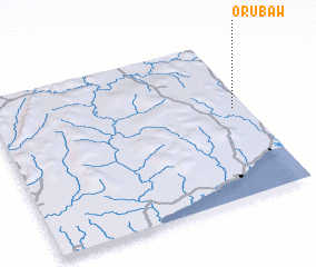 Places with similar names to Orubaw, Ghana ::
Disclaimer :: Information on this page comes without warranty of any kind |
||
|
Where is Orubaw? Elevation and coordinates ::
Latitude (lat): 5°34'0"N Longitude (lon): 1°3'0"W
Elevation (approx.): 143m (map arrows pan, magnifying glasses zoom) |
||
|
Visiting Orubaw? Hotel/Accommodation ::
Book a hotel in Orubaw Travel Guide ::
Buy a travel guide for Ghana rental cars ::
car rental offers GPS waypoint ::
download a GPX waypoint (PoI) of Orubaw for your GPS receiver
|
||