|
search place name
|
||
Pantampo (Ghana)Pantampo is a town in Ghana. An overview map of the region around Pantampo is displayed below.
regional and 3d topo map of Pantampo, Ghana ::

Pantampo airports ::
The nearest airport is ACC - Accra Kotoka Intl, located 28.0 km east of Pantampo.
Other airports nearby include TKD - Takoradi (167.8 km south west), LFW - Lome Gnassingbe Eyadema Intl (196.6 km east), NYI - Sunyani (290.1 km north west), Nearby towns ::
Anafro (3.7km west) //
Amanfro (3.7km east) //
Oduponkpehe (3.7km south) //
Anyino (4.1km north west) //
Odupon (4.1km north west) //
Domiabra (5.2km north east) //
Asabaham (5.6km north) //
Juabin (5.5km west) //
Tokuse (5.8km east) //
Opeman (5.8km west) //
Bruburam (6.7km south west) //
Dakuyau (7.6km west) //
Danchira (7.6km north) //
Papasi (7.8km north west) //
Tebu (8.3km north west) //
Joma (8.3km north east) //
Owulabu (9.3km north west) //
Kokrobite (9.3km south east) //
Nkwantanang (10.5km south west) //
Afuaman (10.5km north east) //
Oshien (10.5km south east) //
[all distances 'as the bird flies' and approximate] 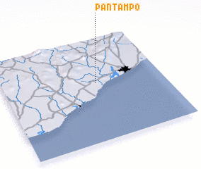
Disclaimer :: Information on this page comes without warranty of any kind |
||
|
Where is Pantampo? Elevation and coordinates ::
Latitude (lat): 5°34'0"N Longitude (lon): 0°25'0"W
Elevation (approx.): 25m (map arrows pan, magnifying glasses zoom) |
||
|
Visiting Pantampo? Hotel/Accommodation ::
Book a hotel in Pantampo Travel Guide ::
Buy a travel guide for Ghana rental cars ::
car rental offers GPS waypoint ::
download a GPX waypoint (PoI) of Pantampo for your GPS receiver
|
||