|
search place name
|
||
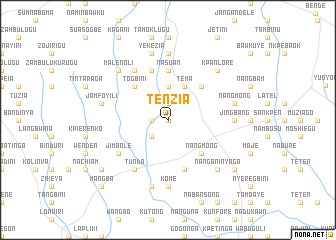
Tenzia (Ghana)Tenzia is a town in Ghana. An overview map of the region around Tenzia is displayed below.
regional and 3d topo map of Tenzia, Ghana ::
Tenzia airports ::
The nearest airport is TML - Tamale, located 124.8 km south west of Tenzia.
Other airports nearby include LRL - Niatougou Niamtougou International (157.2 km south east), OUA - Ouagadougou (256.7 km north west), Nearby towns ::
Kpokpawgbini (0.0km north) //
Sambok (1.8km west) //
Jegori (1.9km north) //
Nyarigbini (2.6km south west) //
Lapelik (2.6km south west) //
Mangbiri (2.6km south west) //
Bunbon (3.7km north) //
Tema (4.1km north east) //
Togbini (5.2km north west) //
Nangmong (5.2km south east) //
Berab (5.2km north east) //
Nasuan (5.6km north) //
Tamakurugu (5.9km north) //
Kokuruge (5.9km south) //
Tunda (6.6km south west) //
Jimbale (6.6km south west) //
Malenoli (6.6km north west) //
Kome (7.4km south) //
Jingbang (7.3km east) //
Nasuan (7.4km north) //
Jamfoyili (7.5km west) //
Duboni (7.6km south) //
Yekezia (7.6km north) //
Nangmong (7.5km east) //
Kudjawen (7.5km east) //
Nanganinyaga (7.8km south east) //
Malenoli (7.8km north west) //
Gulugu (7.8km north west) //
Kpanlore (7.8km north east) //
[all distances 'as the bird flies' and approximate]  Places with similar names to Tenzia, Ghana ::
Disclaimer :: Information on this page comes without warranty of any kind |
||
|
Where is Tenzia? Elevation and coordinates ::
Latitude (lat): 10°27'0"N Longitude (lon): 0°10'0"W
Elevation (approx.): 237m (map arrows pan, magnifying glasses zoom) |
||
|
Visiting Tenzia? Hotel/Accommodation ::
Book a hotel in Tenzia Travel Guide ::
Buy a travel guide for Ghana rental cars ::
car rental offers GPS waypoint ::
download a GPX waypoint (PoI) of Tenzia for your GPS receiver
|
||