|
search place name
|
||
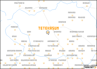
Tetekasum (Ghana)Tetekasum is a town in Ghana. An overview map of the region around Tetekasum is displayed below.
regional and 3d topo map of Tetekasum, Ghana ::
Tetekasum airports ::
The nearest airport is ACC - Accra Kotoka Intl, located 56.3 km south east of Tetekasum.
Other airports nearby include TKD - Takoradi (190.7 km south west), LFW - Lome Gnassingbe Eyadema Intl (191.2 km east), NYI - Sunyani (254.0 km north west), Nearby towns ::
Suhum (2.6km north east) //
Okorasi (3.7km east) //
Wanabenya (4.1km south east) //
Nyamihene (5.2km south west) //
Aboabo (5.2km south west) //
Amanasi (5.2km south east) //
Kukosu (5.9km south) //
Tetekrowa (5.9km south) //
Amanhia (6.7km north east) //
Domi (7.4km west) //
Abude (7.4km south) //
Obonwu (7.4km south) //
Amanasi (7.6km east) //
Mankron (7.8km south east) //
Adumadum (7.8km south west) //
Chenkudebi (7.8km south west) //
Mfranta (8.3km south west) //
Anum (8.3km south east) //
Aboabo (8.3km south east) //
Amiama (9.2km south west) //
Asuboi (9.2km south east) //
Faotri Kosie (9.2km south west) //
[all distances 'as the bird flies' and approximate]  Places with similar names to Tetekasum, Ghana ::
// Tetikasum (GH)
Disclaimer :: Information on this page comes without warranty of any kind |
||
|
Where is Tetekasum? Elevation and coordinates ::
Latitude (lat): 6°1'0"N Longitude (lon): 0°28'0"W
Elevation (approx.): 228m (map arrows pan, magnifying glasses zoom) |
||
|
Visiting Tetekasum? Hotel/Accommodation ::
Book a hotel in Tetekasum Travel Guide ::
Buy a travel guide for Ghana rental cars ::
car rental offers GPS waypoint ::
download a GPX waypoint (PoI) of Tetekasum for your GPS receiver
|
||