|
search place name
|
||
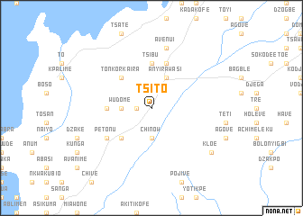
Tsito (Ghana)Tsito is a town in Ghana. An overview map of the region around Tsito is displayed below.
regional and 3d topo map of Tsito, Ghana ::
Tsito airports ::
The nearest airport is ACC - Accra Kotoka Intl, located 114.1 km south west of Tsito.
Other airports nearby include LFW - Lome Gnassingbe Eyadema Intl (114.9 km east), Nearby towns ::
Glime (1.8km west) //
Chinow (3.7km south) //
Wudome (3.7km west) //
Anyirawasi (4.1km north east) //
Batokope (5.2km south west) //
Tonkor-Kaira (5.2km north west) //
Tsibu (5.6km north) //
Peki Blengo (5.5km west) //
Apeviape (5.5km west) //
Avetile (5.5km west) //
Jobati (5.5km west) //
Chameyi (5.5km west) //
Kwanta (5.9km north) //
Petonu (6.7km south west) //
Avenui (7.6km north) //
Kloe (9.2km south east) //
[all distances 'as the bird flies' and approximate] 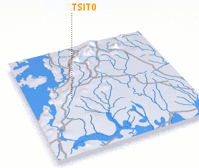 Places with similar names to Tsito, Ghana ::
Disclaimer :: Information on this page comes without warranty of any kind |
||
|
Where is Tsito? Elevation and coordinates ::
Latitude (lat): 6°32'0"N Longitude (lon): 0°17'0"W
Elevation (approx.): 131m (map arrows pan, magnifying glasses zoom) |
||
|
Visiting Tsito? Hotel/Accommodation ::
Book a hotel in Tsito Travel Guide ::
Buy a travel guide for Ghana rental cars ::
car rental offers GPS waypoint ::
download a GPX waypoint (PoI) of Tsito for your GPS receiver
|
||