|
search place name
|
||
Winneba (Ghana)Winneba is a town in Ghana. An overview map of the region around Winneba is displayed below.
regional and 3d topo map of Winneba, Ghana ::

Winneba airports ::
The nearest airport is ACC - Accra Kotoka Intl, located 58.2 km north east of Winneba.
Other airports nearby include TKD - Takoradi (137.2 km west), LFW - Lome Gnassingbe Eyadema Intl (226.8 km north east), Nearby towns ::
Asamaniba (2.6km north east) //
Ateitu (3.7km north) //
Asubonpani (4.1km north east) //
Toansa (4.1km north east) //
Nsuechiri (5.2km north east) //
Wadabeba (5.2km north east) //
Munianu (5.8km west) //
Bidwadzi (5.8km west) //
Kwenue (6.7km north west) //
Jahadzi (6.7km north east) //
Mpata (7.4km north) //
Mankwadzi (7.6km west) //
Atachera (7.6km north) //
Pomadi Brofoyedru (8.3km north west) //
Ojinjinadzi (9.3km north east) //
Aseibu (10.5km north west) //
[all distances 'as the bird flies' and approximate] 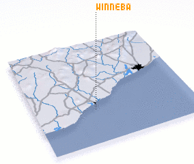 Places with similar names to Winneba, Ghana ::
Disclaimer :: Information on this page comes without warranty of any kind |
||
|
Where is Winneba? Elevation and coordinates ::
Latitude (lat): 5°20'0"N Longitude (lon): 0°37'0"W
Elevation (approx.): -32768m (map arrows pan, magnifying glasses zoom) |
||
|
Visiting Winneba? Hotel/Accommodation ::
Book a hotel in Winneba Travel Guide ::
Buy a travel guide for Ghana rental cars ::
car rental offers GPS waypoint ::
download a GPX waypoint (PoI) of Winneba for your GPS receiver
|
||