|
search place name
|
||
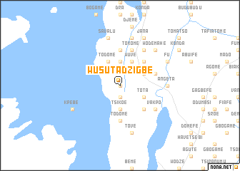
Wusuta Dzigbe (Ghana)Wusuta Dzigbe is a town in Ghana. An overview map of the region around Wusuta Dzigbe is displayed below.
regional and 3d topo map of Wusuta Dzigbe, Ghana ::
Wusuta Dzigbe airports ::
The nearest airport is LFW - Lome Gnassingbe Eyadema Intl, located 133.4 km south east of Wusuta Dzigbe.
Other airports nearby include ACC - Accra Kotoka Intl (143.4 km south), Nearby towns ::
Hoto (0.0km north) //
Tokpeta (0.0km north) //
Hotonyigbe (0.0km north) //
Wa (1.9km south) //
Huime (3.7km south) //
Dzigbe (3.7km south) //
Tsikoe (3.7km south) //
Anyinabasi (3.7km south) //
Agadome (3.7km north) //
Tota (4.1km south east) //
Afeyi (4.1km north east) //
Dutayingbe (4.1km north east) //
Gbohome (4.1km north east) //
Adomi (4.1km north east) //
Wuve (4.1km north east) //
Todome (4.1km north west) //
Awate Todzi (4.1km north west) //
Dukuma (5.2km south east) //
Fodome (5.2km north east) //
Todome (5.6km south) //
Ayingbe (5.6km north) //
Todji (5.8km east) //
Agata (5.9km north) //
Tokome (5.9km north) //
Agatayingbe (5.9km north) //
Vakpo (6.6km south east) //
Gblenko (6.7km north east) //
Adame (6.7km north east) //
Angeta (7.4km east) //
[all distances 'as the bird flies' and approximate]  Places with similar names to Wusuta Dzigbe, Ghana :: Disclaimer :: Information on this page comes without warranty of any kind |
||
|
Where is Wusuta Dzigbe? Elevation and coordinates ::
Latitude (lat): 6°50'0"N Longitude (lon): 0°15'0"W
Elevation (approx.): 252m (map arrows pan, magnifying glasses zoom) |
||
|
Visiting Wusuta Dzigbe? Hotel/Accommodation ::
Book a hotel in Wusuta Dzigbe Travel Guide ::
Buy a travel guide for Ghana rental cars ::
car rental offers GPS waypoint ::
download a GPX waypoint (PoI) of Wusuta Dzigbe for your GPS receiver
|
||