|
search place name
|
||
Agua Fría (Oaxaca, Mexico)Agua Fría is a town in the Oaxaca region of Mexico. An overview map of the region around Agua Fría is displayed below.
regional and 3d topo map of Agua Fría, Mexico ::

Agua Fría airports ::
The nearest airport is OAX - Oaxaca Xoxocotlan Intl, located 56.2 km north east of Agua Fría.
Other airports nearby include PXM - Puerto Escondido Intl (75.4 km south), HUX - Bahias Dehuatulco Bahias De Huatulco Intl (114.1 km south east), TCN - Tehuacan (220.9 km north), Nearby towns ::
Tierra Colorada (2.3km north) //
San Francisco Sola (3.6km south) //
Nachihui (3.4km west) //
Yoganta (3.7km north west) //
El Obisbo (3.8km north east) //
San Miguel Sola de Vega (3.9km south west) //
Santa María Sola (3.9km north west) //
San Ildefonso Sola (4.6km south west) //
Santos Reyes Sola (5.6km south) //
Gulera (6.0km south) //
San Ildefonso El Viejo (6.6km north) //
Santa Rosa Matagallinas (6.7km north west) //
Santa Inés Sola (8.2km south east) //
La Hacienda (10.6km north west) //
El Vado (10.6km north east) //
[all distances 'as the bird flies' and approximate] 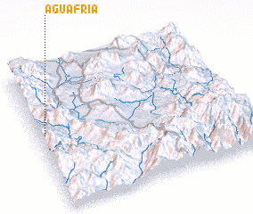 Places with similar names to Agua Fría, Mexico ::
Disclaimer :: Information on this page comes without warranty of any kind |
||
|
Where is Agua Fría? Elevation and coordinates ::
Latitude (lat): 16°32'55"N Longitude (lon): 96°58'7"W
Elevation (approx.): 1544m (map arrows pan, magnifying glasses zoom) |
||
|
Visiting Agua Fría? Hotel/Accommodation ::
Book a hotel in Agua Fría Travel Guide ::
Buy a travel guide for Mexico rental cars ::
car rental offers GPS waypoint ::
download a GPX waypoint (PoI) of Agua Fría for your GPS receiver
|
||