|
search place name
|
||
Albarradas (Oaxaca, Mexico)Albarradas is a town in the Oaxaca region of Mexico. An overview map of the region around Albarradas is displayed below.
regional and 3d topo map of Albarradas, Mexico ::

Albarradas airports ::
The nearest airport is OAX - Oaxaca Xoxocotlan Intl, located 42.9 km west of Albarradas.
Other airports nearby include HUX - Bahias Dehuatulco Bahias De Huatulco Intl (126.5 km south), PXM - Puerto Escondido Intl (140.6 km south west), TCN - Tehuacan (209.5 km north west), MTT - Minatitlan (227.8 km north east), Nearby towns ::
Guadalupe Victoria (1.5km north) //
Palenque (2.6km south west) //
Crucero (3.3km north west) //
Xaaga (3.5km west) //
Corral del Cerro (4.5km north east) //
Hoaguía (7.0km south east) //
San Pablo Villa de Mitla (7.1km west) //
Naranjas (7.6km north) //
San Juan del Río (7.3km east) //
Santiago Matatlán (7.7km south west) //
San Lorenzo Albarradas (8.1km east) //
San Miguel del Valle (10.3km north east) //
[all distances 'as the bird flies' and approximate] 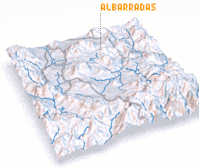 Places with similar names to Albarradas, Mexico ::
// Albaredos (ES)
// Albaredos (ES)
// Albarradas (MX)
// Albarradas (MX)
// Albertos (BR)
// Alburtis (US)
Disclaimer :: Information on this page comes without warranty of any kind |
||
|
Where is Albarradas? Elevation and coordinates ::
Latitude (lat): 16°55'0"N Longitude (lon): 96°20'0"W
Elevation (approx.): 1754m (map arrows pan, magnifying glasses zoom) |
||
|
Visiting Albarradas? Hotel/Accommodation ::
Book a hotel in Albarradas Travel Guide ::
Buy a travel guide for Mexico rental cars ::
car rental offers GPS waypoint ::
download a GPX waypoint (PoI) of Albarradas for your GPS receiver
|
||