|
search place name
|
||
Albercas (San Luis Potosí, Mexico)Albercas is a town in the San Luis Potosí region of Mexico. An overview map of the region around Albercas is displayed below.
regional and 3d topo map of Albercas, Mexico ::

Albercas airports ::
The nearest airport is TSL - Tamuin, located 111.3 km north east of Albercas.
Other airports nearby include QRO - Queretaro Intercontinental (118.3 km south), SLP - San Luis Potosi Ponciano Arriaga Intl (138.0 km north west), BJX - Del Bajio Guanajuato Intl (189.2 km west), PCA - Pachuca Ingeniero Juan Guillermo Villasana (199.7 km south east), Nearby towns ::
El Quelital (1.7km east) //
La Puerta del Tanque (2.5km north west) //
San Ciro de Acosta (3.9km north west) //
Laguna Tepehuaje (4.1km south west) //
Charco del Milagro (3.9km south west) //
Corral Toro (5.6km north) //
El Órgano (5.6km south) //
Canela (5.2km west) //
El Pitahayo (5.2km west) //
Polvo (5.8km south) //
La Trinidad (6.4km south west) //
Carrizal (7.1km east) //
Paso de Jesús (7.6km north) //
Guerrero (7.6km south) //
Encinos (7.6km north east) //
San Francisco (7.6km north west) //
Carrizal (7.8km north east) //
Solano (8.2km south east) //
[all distances 'as the bird flies' and approximate] 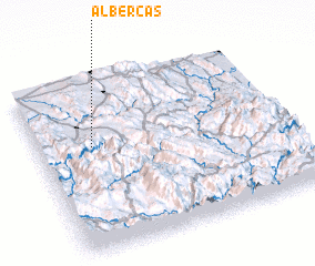 Places with similar names to Albercas, Mexico ::
// Albarkaïzé (NE)
// Albercas (MX)
Disclaimer :: Information on this page comes without warranty of any kind |
||
|
Where is Albercas? Elevation and coordinates ::
Latitude (lat): 21°37'0"N Longitude (lon): 99°47'0"W
Elevation (approx.): 968m (map arrows pan, magnifying glasses zoom) |
||
|
Visiting Albercas? Hotel/Accommodation ::
Book a hotel in Albercas Travel Guide ::
Buy a travel guide for Mexico rental cars ::
car rental offers GPS waypoint ::
download a GPX waypoint (PoI) of Albercas for your GPS receiver
|
||