|
search place name
|
||
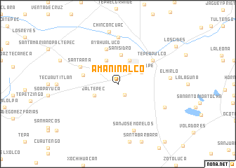
Amaninalco (Hidalgo, Mexico)Amaninalco is a town in the Hidalgo region of Mexico. An overview map of the region around Amaninalco is displayed below.
regional and 3d topo map of Amaninalco, Mexico ::
Amaninalco airports ::
The nearest airport is PCA - Pachuca Ingeniero Juan Guillermo Villasana, located 41.0 km north west of Amaninalco.
Other airports nearby include TXA - Tlaxcala (50.5 km south east), MEX - Mexico City Licenciado Benito Juarez Intl (60.5 km south west), PBC - Puebla Hermanos Serdan Intl (69.8 km south), TLC - Toluca Licenciado Adolfo Lopez Mateos Intl (111.2 km south west), Nearby towns ::
Irolo (2.0km south east) //
Ciudad Sahagún (2.5km north east) //
San Vicente (4.1km north east) //
Guadalupe (4.0km north east) //
San Miguel Ometusco (4.1km north west) //
Jaltepec (4.0km south west) //
San Isidro (4.7km north) //
Xala (5.4km west) //
Ayahualuco (5.8km north) //
Santa Ana (6.3km north west) //
Tepeapulco (6.4km north east) //
Tlanalapan (7.4km north) //
San José Morelos (7.8km south) //
Acopinalco (7.9km south east) //
El Mirlo (7.9km east) //
Chinconcuac (8.4km north) //
[all distances 'as the bird flies' and approximate]  Places with similar names to Amaninalco, Mexico :: Disclaimer :: Information on this page comes without warranty of any kind |
||
|
Where is Amaninalco? Elevation and coordinates ::
Latitude (lat): 19°45'0"N Longitude (lon): 98°36'0"W
Elevation (approx.): 2451m (map arrows pan, magnifying glasses zoom) |
||
|
Visiting Amaninalco? Hotel/Accommodation ::
Book a hotel in Amaninalco Travel Guide ::
Buy a travel guide for Mexico rental cars ::
car rental offers GPS waypoint ::
download a GPX waypoint (PoI) of Amaninalco for your GPS receiver
|
||