|
search place name
|
||
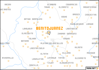
Benito Juárez (Hidalgo, Mexico)Benito Juárez is a town in the Hidalgo region of Mexico. An overview map of the region around Benito Juárez is displayed below.
regional and 3d topo map of Benito Juárez, Mexico ::
Benito Juárez airports ::
The nearest airport is QRO - Queretaro Intercontinental, located 84.0 km west of Benito Juárez.
Other airports nearby include PCA - Pachuca Ingeniero Juan Guillermo Villasana (98.5 km south east), MEX - Mexico City Licenciado Benito Juarez Intl (149.9 km south), TSL - Tamuin (154.5 km north east), TLC - Toluca Licenciado Adolfo Lopez Mateos Intl (158.1 km south), Nearby towns ::
Detzaní (1.0km south west) //
El Barrón (1.4km north west) //
El Álamo (1.9km south west) //
La Nopalera (2.5km west) //
Dedhó (2.7km north west) //
Puerto Ángel (3.9km north west) //
Plutarco Elías Calles (4.4km south) //
Zimapán (4.5km east) //
Cruz Pintada (5.2km south east) //
Pared Blanca (5.2km north west) //
Álvaro Obregón (5.8km south east) //
Cuauhtémoc (6.0km south west) //
San Guillermo (6.1km north west) //
San Felipe (6.5km north west) //
Tolimán (6.4km south west) //
Fresnillo y San Miguel (6.8km north) //
Temuthe (6.8km south east) //
Xindho (6.7km east) //
La Purísima Fresnillo (7.2km north west) //
El Salitre (7.1km south east) //
La Estanzuela (7.5km south west) //
Xodhé (7.9km north east) //
El Mezquite (7.7km west) //
La Majada (7.8km west) //
El Cuarto (8.2km south east) //
Verdosas (8.3km north) //
El Tathi (8.5km south) //
San Pedro (8.0km east) //
La Estancia (8.0km east) //
[all distances 'as the bird flies' and approximate] 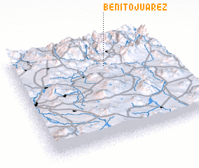 Places with similar names to Benito Juárez, Mexico ::
// Benito Juarez (MX)
// Benito Juarez (MX)
// Benito Juarez (MX)
// Benito Juarez (MX)
// Benito Juarez (MX)
// Benito Juarez (MX)
// Benito Juárez (MX)
// Benito Juárez (MX)
// Benito Juárez (MX)
// Benito Juárez (MX)
Disclaimer :: Information on this page comes without warranty of any kind |
||
|
Where is Benito Juárez? Elevation and coordinates ::
Latitude (lat): 20°45'20"N Longitude (lon): 99°23'35"W
Elevation (approx.): 1877m (map arrows pan, magnifying glasses zoom) |
||
|
Visiting Benito Juárez? Hotel/Accommodation ::
Book a hotel in Benito Juárez Travel Guide ::
Buy a travel guide for Mexico rental cars ::
car rental offers GPS waypoint ::
download a GPX waypoint (PoI) of Benito Juárez for your GPS receiver
|
||