|
search place name
|
||
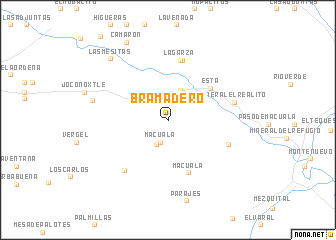
Bramadero (Guanajuato, Mexico)Bramadero is a town in the Guanajuato region of Mexico. An overview map of the region around Bramadero is displayed below.
regional and 3d topo map of Bramadero, Mexico ::
Bramadero airports ::
The nearest airport is SLP - San Luis Potosi Ponciano Arriaga Intl, located 98.9 km north west of Bramadero.
Other airports nearby include QRO - Queretaro Intercontinental (108.1 km south), BJX - Del Bajio Guanajuato Intl (139.8 km south west), TSL - Tamuin (161.5 km east), MLM - Morelia General Francisco J Mujica Intl (207.1 km south), Nearby towns ::
Macuala (2.6km south) //
Mesa La Estacada (3.0km south) //
El Saucillo (3.6km north) //
Esta (5.7km north east) //
Macuala (6.2km south) //
La Angostura (6.7km north) //
La Garza (6.8km north) //
Arroyo Colorado (6.8km south east) //
Placita Los Gallos (7.2km south west) //
Mineral El Realito (7.2km east) //
El Bramador (8.1km west) //
Las Mesitas (9.0km north west) //
Camarón (9.6km north west) //
[all distances 'as the bird flies' and approximate] 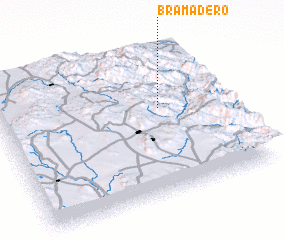 Places with similar names to Bramadero, Mexico ::
// Bayramdere (TR)
// Bayramdere (TR)
// Burmadere (TR)
// Bar-Emtor (RU)
// Barmūdār (IR)
// Brahmottar (BD)
// Bramadora (CO)
// Bramadero (EC)
// Bramador (MX)
// Bramador (MX)
Disclaimer :: Information on this page comes without warranty of any kind |
||
|
Where is Bramadero? Elevation and coordinates ::
Latitude (lat): 21°35'19"N Longitude (lon): 100°17'34"W
Elevation (approx.): 1332m (map arrows pan, magnifying glasses zoom) |
||
|
Visiting Bramadero? Hotel/Accommodation ::
Book a hotel in Bramadero Travel Guide ::
Buy a travel guide for Mexico rental cars ::
car rental offers GPS waypoint ::
download a GPX waypoint (PoI) of Bramadero for your GPS receiver
|
||