|
search place name
|
||
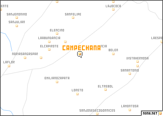
Campechana (Zacatecas, Mexico)Campechana is a town in the Zacatecas region of Mexico. An overview map of the region around Campechana is displayed below.
regional and 3d topo map of Campechana, Mexico ::
Campechana airports ::
The nearest airport is ZCL - Zacatecas General Leobardo C Ruiz Intl, located 100.3 km south west of Campechana.
Other airports nearby include SLP - San Luis Potosi Ponciano Arriaga Intl (195.2 km south east), AGU - Aguascalientes Jesus Teran Intl (214.5 km south), SLW - Saltillo Plan De Guadalupe Intl (244.0 km north east), TRC - Torreon Intl (251.2 km north west), Nearby towns ::
Providencia (3.9km north east) //
El Burrito (5.0km north west) //
Belén (6.9km east) //
El Capirote (7.0km west) //
El Encino (7.5km north west) //
Emiliano Zapata (7.5km south west) //
La Abundancia (7.7km north west) //
Loreto (8.4km south) //
El Trébol (9.0km south east) //
[all distances 'as the bird flies' and approximate] 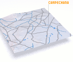 Places with similar names to Campechana, Mexico ::
// Campasion (PH)
// Kämpchen (DE)
// Campechano (VE)
// Campechano (VE)
// Campechano (VE)
// Kompótion (GR)
Disclaimer :: Information on this page comes without warranty of any kind |
||
|
Where is Campechana? Elevation and coordinates ::
Latitude (lat): 23°38'0"N Longitude (lon): 102°7'0"W
Elevation (approx.): 2004m (map arrows pan, magnifying glasses zoom) |
||
|
Visiting Campechana? Hotel/Accommodation ::
Book a hotel in Campechana Travel Guide ::
Buy a travel guide for Mexico rental cars ::
car rental offers GPS waypoint ::
download a GPX waypoint (PoI) of Campechana for your GPS receiver
|
||