|
search place name
|
||
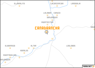
Cañada Ancha (Sonora, Mexico)Cañada Ancha is a town in the Sonora region of Mexico. An overview map of the region around Cañada Ancha is displayed below.
regional and 3d topo map of Cañada Ancha, Mexico ::
Cañada Ancha airports ::
The nearest airport is HMO - Hermosillo General Ignacio P Garcia Intl, located 100.7 km south west of Cañada Ancha.
Other airports nearby include GYM - Guaymas General Jose Maria Yanez Intl (190.9 km south west), NOG - Nogales Intl (202.0 km north west), Nearby towns ::
Estancia (1.9km north) //
Mazocahui (2.5km south east) //
La Aurora (3.7km north) //
Puertecitos (3.7km north) //
San Joaquín (5.8km north) //
La Labor (7.4km north) //
Altar (7.4km south west) //
Coruco (8.1km north east) //
Salcido (8.5km south west) //
[all distances 'as the bird flies' and approximate]  Places with similar names to Cañada Ancha, Mexico ::
// Kendenich (DE)
// Cañada Ancha (MX)
// Cañada Ancha (MX)
// Cañada Ancha (MX)
// Kantensha (ZM)
// Cañada Ancha (MX)
Disclaimer :: Information on this page comes without warranty of any kind |
||
|
Where is Cañada Ancha? Elevation and coordinates ::
Latitude (lat): 29°33'0"N Longitude (lon): 110°9'0"W
Elevation (approx.): 571m (map arrows pan, magnifying glasses zoom) |
||
|
Visiting Cañada Ancha? Hotel/Accommodation ::
Book a hotel in Cañada Ancha Travel Guide ::
Buy a travel guide for Mexico rental cars ::
car rental offers GPS waypoint ::
download a GPX waypoint (PoI) of Cañada Ancha for your GPS receiver
|
||