|
search place name
|
||
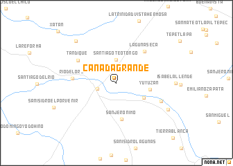
Cañada Grande (Oaxaca, Mexico)Cañada Grande is a town in the Oaxaca region of Mexico. An overview map of the region around Cañada Grande is displayed below.
regional and 3d topo map of Cañada Grande, Mexico ::
Cañada Grande airports ::
The nearest airport is TCN - Tehuacan, located 90.4 km north of Cañada Grande.
Other airports nearby include OAX - Oaxaca Xoxocotlan Intl (115.4 km south east), PBC - Puebla Hermanos Serdan Intl (184.8 km north west), PXM - Puerto Escondido Intl (206.2 km south), TXA - Tlaxcala (215.3 km north), Nearby towns ::
Tamazulapan del Progreso (3.1km west) //
Santiago Teotongo (3.8km north) //
Chocani (4.9km south east) //
Yuyuzán (5.2km east) //
San Jerónimo (5.9km south) //
Laguna Seca (6.7km north east) //
Río del Oro (6.8km west) //
Tandique (6.9km north west) //
Santiago Tejupan (7.5km south east) //
San Antonio Acutla (9.0km south east) //
San Sebastián Tutla (9.2km north west) //
[all distances 'as the bird flies' and approximate]  Places with similar names to Cañada Grande, Mexico ::
// Quinta Grande (PT)
// Cañada Grande (MX)
// Cañada Grande (MX)
// Cañada Grande (MX)
// Cañada Grande (MX)
// Cañada Grande (MX)
// Cañada Grande (MX)
// Cañada Grande (HN)
// Cañada Grande (NI)
// Canto Grande (PE)
Disclaimer :: Information on this page comes without warranty of any kind |
||
|
Where is Cañada Grande? Elevation and coordinates ::
Latitude (lat): 17°41'20"N Longitude (lon): 97°32'29"W
Elevation (approx.): 2107m (map arrows pan, magnifying glasses zoom) |
||
|
Visiting Cañada Grande? Hotel/Accommodation ::
Book a hotel in Cañada Grande Travel Guide ::
Buy a travel guide for Mexico rental cars ::
car rental offers GPS waypoint ::
download a GPX waypoint (PoI) of Cañada Grande for your GPS receiver
|
||