|
search place name
|
||
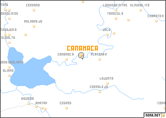
Canamaca (Sinaloa, Mexico)Canamaca is a town in the Sinaloa region of Mexico. An overview map of the region around Canamaca is displayed below.
regional and 3d topo map of Canamaca, Mexico ::
Canamaca airports ::
The nearest airport is CUL - Culiacan Intl, located 47.7 km west of Canamaca.
Other airports nearby include MZT - Mazatlan General Rafael Buelna Intl (203.7 km south), Nearby towns ::
 Places with similar names to Canamaca, Mexico ::
// Canmuga (PH)
// Canmaag (PH)
// Kanmugao (PH)
// Qinamakë (AL)
// Căianu Mic (RO)
// Căianu Mic (RO)
// Kenia-Moke (CD)
// Cuanamuco (MX)
// Kinambogo (UG)
// Kunamaki (SD)
Disclaimer :: Information on this page comes without warranty of any kind |
||
|
Where is Canamaca? Elevation and coordinates ::
Latitude (lat): 24°52'0"N Longitude (lon): 107°1'0"W
Elevation (approx.): 201m (map arrows pan, magnifying glasses zoom) |
||
|
Visiting Canamaca? Hotel/Accommodation ::
Book a hotel in Canamaca Travel Guide ::
Buy a travel guide for Mexico rental cars ::
car rental offers GPS waypoint ::
download a GPX waypoint (PoI) of Canamaca for your GPS receiver
|
||