|
search place name
|
||
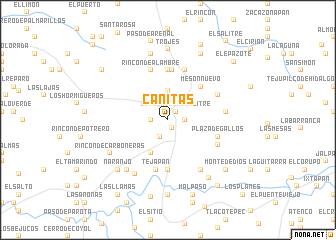
Cañitas (México, Mexico)Cañitas is a town in the México region of Mexico. An overview map of the region around Cañitas is displayed below.
regional and 3d topo map of Cañitas, Mexico ::
Cañitas airports ::
The nearest airport is TLC - Toluca Licenciado Adolfo Lopez Mateos Intl, located 91.7 km north east of Cañitas.
Other airports nearby include CVJ - Cuernavaca General Mariano Matamoros (107.8 km east), MLM - Morelia General Francisco J Mujica Intl (133.9 km north west), MEX - Mexico City Licenciado Benito Juarez Intl (142.2 km north east), ZIH - Ixtapa Zihuatanejo Intl (187.4 km south west), Nearby towns ::
Los Pinzanes (1.0km south east) //
El Puerto del Salitre (1.3km north east) //
Jequinicuil (1.8km east) //
Los Naranjos (1.8km west) //
Pie de la Loma (2.1km south west) //
Rincón de San Sebastián (3.2km north) //
La Mesa (4.1km south west) //
Mesón Nuevo (5.1km north east) //
Estanco Viejo (5.6km north) //
Los Limones (5.6km south) //
Capiri (5.6km north) //
Tejapan (5.7km south) //
Benitez (5.8km north) //
Plaza de Gallos (5.6km east) //
Las Juntas (5.6km east) //
Rincón de Alambre (5.8km north) //
Paso de Vigas (6.0km north east) //
San Mateo (6.0km south east) //
Cuadrilla de López (6.2km east) //
Acamuchitlán (6.6km south east) //
El Aguacate (6.6km south east) //
El Ciruelo (7.0km south west) //
El Molino (7.1km south west) //
Rincón de Carboneras (7.2km south west) //
San Antonio (7.6km north) //
Naranjo (7.7km south west) //
Trojes (7.9km north) //
Cerro Alto (7.8km south east) //
Arroyo Seco (8.2km north east) //
[all distances 'as the bird flies' and approximate] 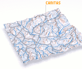 Places with similar names to Cañitas, Mexico ::
Disclaimer :: Information on this page comes without warranty of any kind |
||
|
Where is Cañitas? Elevation and coordinates ::
Latitude (lat): 18°52'0"N Longitude (lon): 100°17'0"W
Elevation (approx.): 1232m (map arrows pan, magnifying glasses zoom) |
||
|
Visiting Cañitas? Hotel/Accommodation ::
Book a hotel in Cañitas Travel Guide ::
Buy a travel guide for Mexico rental cars ::
car rental offers GPS waypoint ::
download a GPX waypoint (PoI) of Cañitas for your GPS receiver
|
||