|
search place name
|
||
Castañon (San Luis Potosí, Mexico)Castañon is a town in the San Luis Potosí region of Mexico. An overview map of the region around Castañon is displayed below.
regional and 3d topo map of Castañon, Mexico ::

Castañon airports ::
The nearest airport is SLP - San Luis Potosi Ponciano Arriaga Intl, located 176.4 km south of Castañon.
Other airports nearby include ZCL - Zacatecas General Leobardo C Ruiz Intl (177.4 km south west), SLW - Saltillo Plan De Guadalupe Intl (195.0 km north), MTY - Monterrey General Mariano Escobedo Intl (246.9 km north east), Nearby towns ::
La Lagunita (7.5km south east) //
Charco Largo (7.7km north east) //
[all distances 'as the bird flies' and approximate] 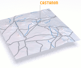 Places with similar names to Castañon, Mexico ::
// Casa Donini (IT)
// Gostynin (PL)
// Gozdanin (PL)
// Gostinino (RU)
// Kostinino (RU)
// Kstinino (RU)
// Častonín (CZ)
// Kaustinen (FI)
// Kastanón (GR)
// Kostániani (GR)
Disclaimer :: Information on this page comes without warranty of any kind |
||
|
Where is Castañon? Elevation and coordinates ::
Latitude (lat): 23°49'0"N Longitude (lon): 101°16'0"W
Elevation (approx.): 1997m (map arrows pan, magnifying glasses zoom) |
||
|
Visiting Castañon? Hotel/Accommodation ::
Book a hotel in Castañon Travel Guide ::
Buy a travel guide for Mexico rental cars ::
car rental offers GPS waypoint ::
download a GPX waypoint (PoI) of Castañon for your GPS receiver
|
||