|
search place name
|
||
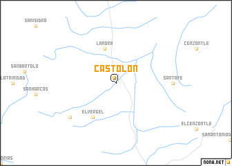
Castolón (Coahuila de Zaragoza, Mexico)Castolón is a town in the Coahuila de Zaragoza region of Mexico. An overview map of the region around Castolón is displayed below.
regional and 3d topo map of Castolón, Mexico ::
Nearby towns ::
Aguachica (5.8km north) //
La Mora (5.8km north) //
El Vergel (6.5km south west) //
El Perdido (8.6km south west) //
[all distances 'as the bird flies' and approximate]  Places with similar names to Castolón, Mexico ::
// Castellano (PH)
// Kastilaan (PH)
// Kastellaun (DE)
// Castellana (IT)
// Castellani (IT)
// Castellone (IT)
// Czatolin (PL)
// Costuleni (RO)
// Castelán (ES)
// Castellana (ES)
Disclaimer :: Information on this page comes without warranty of any kind |
||
|
Where is Castolón? Elevation and coordinates ::
Latitude (lat): 27°40'0"N Longitude (lon): 103°29'0"W
Elevation (approx.): 1243m (map arrows pan, magnifying glasses zoom) |
||
|
Visiting Castolón? Hotel/Accommodation ::
Book a hotel in Castolón Travel Guide ::
Buy a travel guide for Mexico rental cars ::
car rental offers GPS waypoint ::
download a GPX waypoint (PoI) of Castolón for your GPS receiver
|
||