|
search place name
|
||
Chiquihuantepec (México, Mexico)Chiquihuantepec is a town in the México region of Mexico. An overview map of the region around Chiquihuantepec is displayed below.
regional and 3d topo map of Chiquihuantepec, Mexico ::

Chiquihuantepec airports ::
The nearest airport is TLC - Toluca Licenciado Adolfo Lopez Mateos Intl, located 59.8 km north east of Chiquihuantepec.
Other airports nearby include CVJ - Cuernavaca General Mariano Matamoros (67.7 km east), MEX - Mexico City Licenciado Benito Juarez Intl (105.4 km north east), MLM - Morelia General Francisco J Mujica Intl (158.2 km north west), PBC - Puebla Hermanos Serdan Intl (163.4 km east), Nearby towns ::
San Francisco (0.0km north) //
Capulmanca (0.9km east) //
Santiago Texcaltitlán (1.8km west) //
Acatitlán (1.8km west) //
El Pedregal (2.6km north east) //
Ahuacatitlán (2.9km south) //
Quinta Manzana (2.9km south) //
Las Mesas (3.2km south east) //
Arroyo Seco (3.5km west) //
Capula (4.1km south west) //
Almoloya de Alquisiras (4.1km south west) //
Santa Maria (4.0km north west) //
Gloria Chica (4.1km north west) //
Los Morales (4.1km north east) //
El Rincón (4.0km south east) //
Las Vueltas (4.4km east) //
Texcapilla (4.7km north) //
San Andrés Tepetitlán (5.1km south east) //
Llano Grande (5.6km north) //
Los Ranchos (5.4km south east) //
Jesús del Monte (5.3km west) //
Rastrojo Largo (5.3km west) //
Chiltepec de Hidalgo (5.6km east) //
San Agustín (5.8km north west) //
Sultepec de Pedro Ascencio de Alquisiras (6.4km south west) //
Venta Morales (6.6km north west) //
San Miguel (6.4km north west) //
Cuauhtenco (6.7km south) //
Pamillas (6.7km north) //
[all distances 'as the bird flies' and approximate] 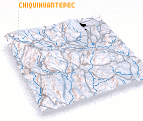 Places with similar names to Chiquihuantepec, Mexico :: Disclaimer :: Information on this page comes without warranty of any kind |
||
|
Where is Chiquihuantepec? Elevation and coordinates ::
Latitude (lat): 18°54'0"N Longitude (lon): 99°54'0"W
Elevation (approx.): 2325m (map arrows pan, magnifying glasses zoom) |
||
|
Visiting Chiquihuantepec? Hotel/Accommodation ::
Book a hotel in Chiquihuantepec Travel Guide ::
Buy a travel guide for Mexico rental cars ::
car rental offers GPS waypoint ::
download a GPX waypoint (PoI) of Chiquihuantepec for your GPS receiver
|
||