|
search place name
|
||
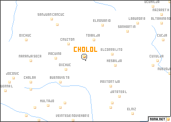
Cholol (Chiapas, Mexico)Cholol is a town in the Chiapas region of Mexico. An overview map of the region around Cholol is displayed below.
regional and 3d topo map of Cholol, Mexico ::
Cholol airports ::
The nearest airport is TGZ - Tuxtla Gutierrez Angel Albino Corzo, located 82.1 km west of Cholol.
Other airports nearby include VSA - Villahermosa C P A Carlos Rovirosa Intl (142.6 km north), CME - Ciudad Del Carmen Intl (211.0 km north), CBV - Coban (250.9 km south east), Nearby towns ::
Oxchuc (4.5km south west) //
Toibiljá (5.0km north) //
Cruztón (5.1km north west) //
El Corralito (5.8km east) //
Pacuiná (6.2km west) //
Mesbiljá (6.3km east) //
Buenavista (7.1km south west) //
Paxtontijá (7.7km south east) //
El Rosario (8.6km north east) //
Tzajalchén (10.0km north west) //
Jatateal (10.5km south east) //
[all distances 'as the bird flies' and approximate]  Places with similar names to Cholol, Mexico ::
// Shiloh Hill (US)
// Šiauleliai (LT)
// Chiliile (RO)
// Chiliile (RO)
// Chulilla (ES)
// Chalālī (IR)
// Chālelū (IR)
// Chāl Ghelāgh (IR)
// Chūlalū (IR)
// Chilili (US)
Disclaimer :: Information on this page comes without warranty of any kind |
||
|
Where is Cholol? Elevation and coordinates ::
Latitude (lat): 16°48'30"N Longitude (lon): 92°18'0"W
Elevation (approx.): 1783m (map arrows pan, magnifying glasses zoom) |
||
|
Visiting Cholol? Hotel/Accommodation ::
Book a hotel in Cholol Travel Guide ::
Buy a travel guide for Mexico rental cars ::
car rental offers GPS waypoint ::
download a GPX waypoint (PoI) of Cholol for your GPS receiver
|
||