|
search place name
|
||
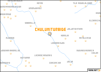
Chulum Iturbide (Chiapas, Mexico)Chulum Iturbide is a town in the Chiapas region of Mexico. An overview map of the region around Chulum Iturbide is displayed below.
regional and 3d topo map of Chulum Iturbide, Mexico ::
Chulum Iturbide airports ::
The nearest airport is VSA - Villahermosa C P A Carlos Rovirosa Intl, located 81.6 km north of Chulum Iturbide.
Other airports nearby include TGZ - Tuxtla Gutierrez Angel Albino Corzo (95.2 km south west), CME - Ciudad Del Carmen Intl (170.5 km north east), Nearby towns ::
Los Naranjos (4.6km south east) //
Morelia (5.4km east) //
Sabanilla (8.0km north west) //
Lázaro Cárdenas (8.7km south) //
[all distances 'as the bird flies' and approximate] 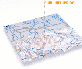 Places with similar names to Chulum Iturbide, Mexico :: Disclaimer :: Information on this page comes without warranty of any kind |
||
|
Where is Chulum Iturbide? Elevation and coordinates ::
Latitude (lat): 17°18'0"N Longitude (lon): 92°34'0"W
Elevation (approx.): 277m (map arrows pan, magnifying glasses zoom) |
||
|
Visiting Chulum Iturbide? Hotel/Accommodation ::
Book a hotel in Chulum Iturbide Travel Guide ::
Buy a travel guide for Mexico rental cars ::
car rental offers GPS waypoint ::
download a GPX waypoint (PoI) of Chulum Iturbide for your GPS receiver
|
||