|
search place name
|
||
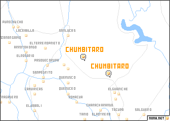
Chumbítaro (Michoacán de Ocampo, Mexico)Chumbítaro is a town in the Michoacán de Ocampo region of Mexico. An overview map of the region around Chumbítaro is displayed below.
regional and 3d topo map of Chumbítaro, Mexico ::
Chumbítaro airports ::
The nearest airport is ZIH - Ixtapa Zihuatanejo Intl, located 126.2 km south west of Chumbítaro.
Other airports nearby include MLM - Morelia General Francisco J Mujica Intl (150.4 km north), TLC - Toluca Licenciado Adolfo Lopez Mateos Intl (154.3 km north east), CVJ - Cuernavaca General Mariano Matamoros (160.9 km east), LZC - Lazard Cardenas Lazaro Cardenas (165.6 km west), Nearby towns ::
Monte Grande (4.0km south west) //
El Limón (4.5km west) //
Querusco (6.1km south west) //
San Lucas (6.6km north west) //
Chumbitaro (6.4km south east) //
Queruceo (8.2km south west) //
La Cruz (8.2km south west) //
Paso de Corupa (8.0km west) //
El Terrero Prieto (8.8km west) //
El Cuajilote (9.4km south east) //
El Guariche (10.2km south east) //
Huarichi (10.7km south east) //
[all distances 'as the bird flies' and approximate] 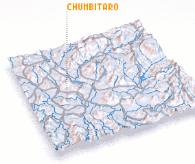 Places with similar names to Chumbítaro, Mexico ::
// Chamtīr (IQ)
// Chamadouro (PT)
// Chāh Maţār (IR)
// Cham Darreh (IR)
// Chāmtāra (BD)
// Chimaidari (IN)
// Chumbitaro (MX)
// Shamīdar (IR)
// Shūmedrī (IR)
// Chamtār (PK)
Disclaimer :: Information on this page comes without warranty of any kind |
||
|
Where is Chumbítaro? Elevation and coordinates ::
Latitude (lat): 18°31'0"N Longitude (lon): 100°45'0"W
Elevation (approx.): 376m (map arrows pan, magnifying glasses zoom) |
||
|
Visiting Chumbítaro? Hotel/Accommodation ::
Book a hotel in Chumbítaro Travel Guide ::
Buy a travel guide for Mexico rental cars ::
car rental offers GPS waypoint ::
download a GPX waypoint (PoI) of Chumbítaro for your GPS receiver
|
||