|
search place name
|
||
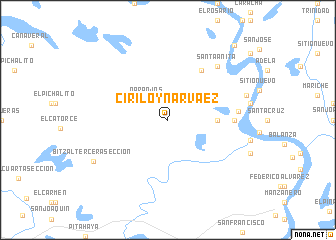
Ciriloy Narváez (Tabasco, Mexico)Ciriloy Narváez is a town in the Tabasco region of Mexico. An overview map of the region around Ciriloy Narváez is displayed below.
regional and 3d topo map of Ciriloy Narváez, Mexico ::
Ciriloy Narváez airports ::
The nearest airport is VSA - Villahermosa C P A Carlos Rovirosa Intl, located 59.8 km west of Ciriloy Narváez.
Other airports nearby include CME - Ciudad Del Carmen Intl (77.3 km north east), TGZ - Tuxtla Gutierrez Angel Albino Corzo (190.1 km south west), CPE - Campeche Ingeniero Alberto Acuna Ongay Intl (264.6 km north east), Nearby towns ::
Naranjos (3.2km north west) //
Chichicaste (5.3km east) //
Zaragoza (6.6km north east) //
La Trinidad (7.0km east) //
San Garabato (7.0km east) //
Zapotal (7.0km east) //
Miramar (7.5km east) //
Santa Anita (8.0km north east) //
Jesús María (8.8km east) //
Bitzal Tercera Sección (9.2km south west) //
Paraíso (10.9km north east) //
[all distances 'as the bird flies' and approximate] 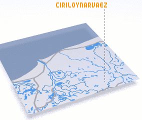 Places with similar names to Ciriloy Narváez, Mexico :: Disclaimer :: Information on this page comes without warranty of any kind |
||
|
Where is Ciriloy Narváez? Elevation and coordinates ::
Latitude (lat): 18°7'0"N Longitude (lon): 92°16'0"W
(map arrows pan, magnifying glasses zoom) |
||
|
Visiting Ciriloy Narváez? Hotel/Accommodation ::
Book a hotel in Ciriloy Narváez Travel Guide ::
Buy a travel guide for Mexico rental cars ::
car rental offers GPS waypoint ::
download a GPX waypoint (PoI) of Ciriloy Narváez for your GPS receiver
|
||