|
search place name
|
||
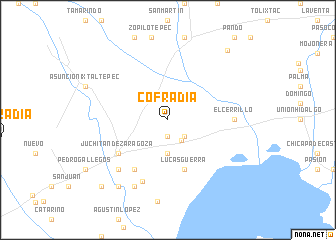
Cofradía (Oaxaca, Mexico)Cofradía is a town in the Oaxaca region of Mexico. An overview map of the region around Cofradía is displayed below.
regional and 3d topo map of Cofradía, Mexico ::
Cofradía airports ::
The nearest airport is HUX - Bahias Dehuatulco Bahias De Huatulco Intl, located 158.3 km south west of Cofradía.
Other airports nearby include MTT - Minatitlan (185.7 km north), OAX - Oaxaca Xoxocotlan Intl (196.7 km west), TGZ - Tuxtla Gutierrez Angel Albino Corzo (207.4 km east), Nearby towns ::
López (1.9km south) //
Laguna Vichu (2.6km south east) //
Victoria (2.7km south east) //
Xobuyache (3.7km south) //
Lucas Guerra (5.8km south) //
Guechihuese (5.8km south) //
Gabino Martínez (6.6km south west) //
Juchitán de Zaragoza (6.5km south west) //
El Cerrillo (7.1km east) //
Mocanet (7.4km south) //
Pasión (7.7km south west) //
La Estancia (8.2km south west) //
Mariano Gerardo (9.1km south west) //
Piedra Larga (10.1km north east) //
Mariano Sánchez (10.3km south west) //
[all distances 'as the bird flies' and approximate] 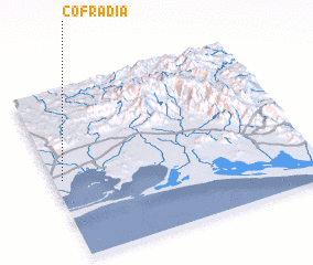 Places with similar names to Cofradía, Mexico ::
Disclaimer :: Information on this page comes without warranty of any kind |
||
|
Where is Cofradía? Elevation and coordinates ::
Latitude (lat): 16°28'0"N Longitude (lon): 94°58'0"W
Elevation (approx.): 18m (map arrows pan, magnifying glasses zoom) |
||
|
Visiting Cofradía? Hotel/Accommodation ::
Book a hotel in Cofradía Travel Guide ::
Buy a travel guide for Mexico rental cars ::
car rental offers GPS waypoint ::
download a GPX waypoint (PoI) of Cofradía for your GPS receiver
|
||