|
search place name
|
||
Cortazar (Tamaulipas, Mexico)Cortazar is a town in the Tamaulipas region of Mexico. An overview map of the region around Cortazar is displayed below.
regional and 3d topo map of Cortazar, Mexico ::

Cortazar airports ::
The nearest airport is MFE - Mcallen Mc Allen Miller Intl, located 23.3 km east of Cortazar.
Other airports nearby include REX - Reynosa General Lucio Blanco Intl (27.5 km south east), HRL - Harlingen Valley Intl (81.9 km east), MAM - Matamoros General Servando Canales Intl (102.5 km south east), BRO - Brownsville South Padre Island Intl (107.2 km east), Nearby towns ::
Cañón de Belén (1.7km east) //
Corral Zamora (3.7km north) //
Arturo Flores (5.0km west) //
San Carlos (6.2km south east) //
Los Fresnos (6.2km north east) //
Reinosa Díaz (7.4km north) //
Zopilote (7.6km south) //
El Estero (7.6km north) //
Abram (9.2km north east) //
Venecia (10.0km north west) //
[all distances 'as the bird flies' and approximate] 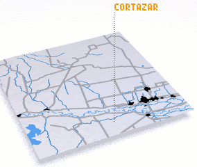 Places with similar names to Cortazar, Mexico ::
// Kürdǝsǝr (AZ)
// Garit Sur (PH)
// Kratzer (AT)
// Critzer (US)
// Curtişoara (RO)
// Curtişoara (RO)
// Curtişoara (RO)
// Cortázar (ES)
// Kertasar (IN)
// Kertasari (ID)
Disclaimer :: Information on this page comes without warranty of any kind |
||
|
Where is Cortazar? Elevation and coordinates ::
Latitude (lat): 26°8'0"N Longitude (lon): 98°28'0"W
Elevation (approx.): 50m (map arrows pan, magnifying glasses zoom) |
||
|
Visiting Cortazar? Hotel/Accommodation ::
Book a hotel in Cortazar Travel Guide ::
Buy a travel guide for Mexico rental cars ::
car rental offers GPS waypoint ::
download a GPX waypoint (PoI) of Cortazar for your GPS receiver
|
||