|
search place name
|
||
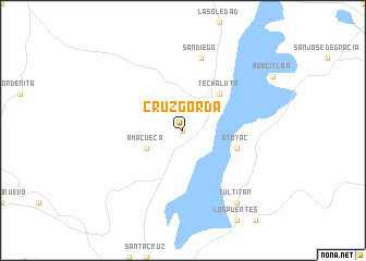
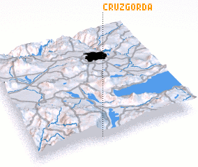
Cruz Gorda (Jalisco, Mexico)Cruz Gorda is a town in the Jalisco region of Mexico. An overview map of the region around Cruz Gorda is displayed below.
regional and 3d topo map of Cruz Gorda, Mexico ::
Cruz Gorda airports ::
The nearest airport is GDL - Guadalajara Don Miguel Hidalgo Y Costilla Intl, located 61.1 km north east of Cruz Gorda.
Other airports nearby include CLQ - Colima (83.7 km south), ZMM - Zamora (136.8 km east), ZLO - Manzanillo Playa De Oro Intl (141.9 km south west), UPN - Uruapan Licenciado Y Gen Ignacio Lopez Rayon (176.6 km south east), Nearby towns ::
 Places with similar names to Cruz Gorda, Mexico ::
// Großkrut (AT)
// Cruz Gorda (MX)
// Gorīz-e Karīdī (IR)
// Griscourt (FR)
// Gräsgård (SE)
// Gräsgärde (SE)
// Kärrsgärde (SE)
Disclaimer :: Information on this page comes without warranty of any kind |
||
|
Where is Cruz Gorda? Elevation and coordinates ::
Latitude (lat): 20°2'0"N Longitude (lon): 103°35'0"W
Elevation (approx.): 1549m (map arrows pan, magnifying glasses zoom) |
||
|
Visiting Cruz Gorda? Hotel/Accommodation ::
Book a hotel in Cruz Gorda Travel Guide ::
Buy a travel guide for Mexico rental cars ::
car rental offers GPS waypoint ::
download a GPX waypoint (PoI) of Cruz Gorda for your GPS receiver
|
||