|
search place name
|
||
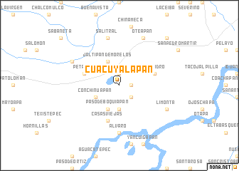
Cuacuyalapan (Veracruz-Llave, Mexico)Cuacuyalapan is a town in the Veracruz-Llave region of Mexico. An overview map of the region around Cuacuyalapan is displayed below.
regional and 3d topo map of Cuacuyalapan, Mexico ::
Cuacuyalapan airports ::
The nearest airport is MTT - Minatitlan, located 21.7 km north east of Cuacuyalapan.
Other airports nearby include VSA - Villahermosa C P A Carlos Rovirosa Intl (197.8 km east), VER - Vera Cruz General Heriberto Jara Intl (207.9 km north west), TGZ - Tuxtla Gutierrez Angel Albino Corzo (232.6 km south east), Nearby towns ::
Coacatla (1.8km east) //
San Lorenzo (1.9km north) //
Cojiapa (2.6km south east) //
La Ciénaga (3.7km south) //
Paso de Boquiapan (4.1km south west) //
Conchinuapan (4.0km south west) //
Jáltipan de Morelos (4.1km north west) //
San Isidro (5.6km east) //
Petapan (5.6km west) //
Casas Viejas (5.8km south) //
Álvaro (7.4km south) //
Salitral (7.6km north) //
Limonta (8.0km south east) //
Oteapan (8.2km north east) //
El Crucero (8.0km north west) //
Cosoleacaque (10.2km north east) //
[all distances 'as the bird flies' and approximate] 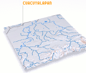 Places with similar names to Cuacuyalapan, Mexico :: Disclaimer :: Information on this page comes without warranty of any kind |
||
|
Where is Cuacuyalapan? Elevation and coordinates ::
Latitude (lat): 17°56'0"N Longitude (lon): 94°41'0"W
Elevation (approx.): 15m (map arrows pan, magnifying glasses zoom) |
||
|
Visiting Cuacuyalapan? Hotel/Accommodation ::
Book a hotel in Cuacuyalapan Travel Guide ::
Buy a travel guide for Mexico rental cars ::
car rental offers GPS waypoint ::
download a GPX waypoint (PoI) of Cuacuyalapan for your GPS receiver
|
||