|
search place name
|
||
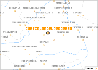
Cuetzalán del Progreso (Puebla, Mexico)Cuetzalán del Progreso is a town in the Puebla region of Mexico. An overview map of the region around Cuetzalán del Progreso is displayed below.
regional and 3d topo map of Cuetzalán del Progreso, Mexico ::
Cuetzalán del Progreso airports ::
The nearest airport is PAZ - Poza Rico Tajin, located 63.3 km north of Cuetzalán del Progreso.
Other airports nearby include TXA - Tlaxcala (88.0 km south west), PBC - Puebla Hermanos Serdan Intl (132.0 km south west), PCA - Pachuca Ingeniero Juan Guillermo Villasana (132.5 km west), TCN - Tehuacan (170.3 km south), Nearby towns ::
Zoquiapan (1.7km west) //
Tzinacapan (2.5km north west) //
Tzicuilán (2.5km south east) //
Xocoyolo (4.1km south west) //
Ecatlán (3.9km north west) //
Taxipehuatl (5.2km east) //
Tetelilla de Islas (6.6km north west) //
Jonotla (7.2km west) //
Reyes de Vallarta (7.6km north) //
Tuzamapan de Galeana (7.6km north west) //
Totopol (8.2km south west) //
Yancuitlalpan (7.9km north east) //
El Teposo (9.1km north east) //
Nauzontla (10.2km south west) //
[all distances 'as the bird flies' and approximate] 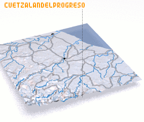 Places with similar names to Cuetzalán del Progreso, Mexico :: Disclaimer :: Information on this page comes without warranty of any kind |
||
|
Where is Cuetzalán del Progreso? Elevation and coordinates ::
Latitude (lat): 20°2'0"N Longitude (lon): 97°31'0"W
Elevation (approx.): 869m (map arrows pan, magnifying glasses zoom) |
||
|
Visiting Cuetzalán del Progreso? Hotel/Accommodation ::
Book a hotel in Cuetzalán del Progreso Travel Guide ::
Buy a travel guide for Mexico rental cars ::
car rental offers GPS waypoint ::
download a GPX waypoint (PoI) of Cuetzalán del Progreso for your GPS receiver
|
||